Android Aviation Apps?

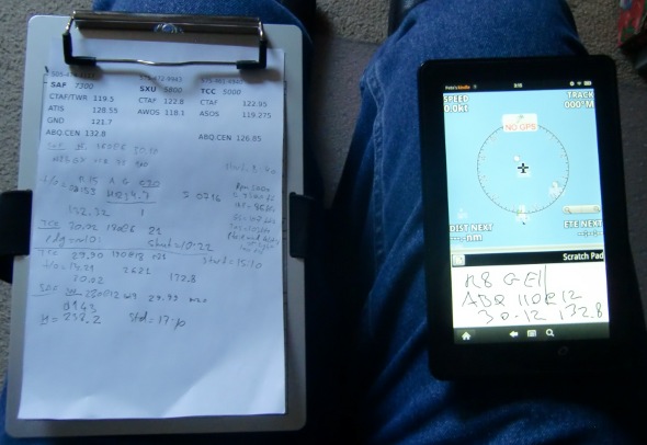
I have foreflight on my Ipad and love it..only thing it's missing is terrain..downside to Ipad is that it takes up too much real estate..would like to have something the size of xoom. Can you tell me what features that foreflight for xoom has? thank you. John

There is no Foreflight for Xoom (or any non-iOS device). There are now some comparable products that show some promise. Nick (Skyhog) has written a little about them here and in other threads.
 
There is no Foreflight for Xoom (or any non-iOS device). There are now some comparable products that show some promise. Nick (Skyhog) has written a little about them here and in other threads.
Well there is Foreflight Weather for Android which pretty much is the just weather portion.
 
Well there is Foreflight Weather for Android which pretty much is the just weather portion.
True, but it's not even comparable to Foreflight for iOS, especially when John was talking about terrain being the only thing missing. It's really a totally different product that happens to be from the same company, and people looking at it expecting something akin to the iOS product are invariably disappointed.
 
True, but it's not even comparable to Foreflight for iOS, especially when John was talking about terrain being the only thing missing. It's really a totally different product that happens to be from the same company, and people looking at it expecting something akin to the iOS product are invariably disappointed.
That's exactly what I said in the post he quoted :)
 
As far as I can tell, the closest you will get to ForeFlight on the android platform (right now) is Naviator. https://market.android.com/details?id=com.onetwentythree.skynav - it's $0 for a 30 day trial, then $15 to buy and $50/yr for a full chart subscription.

It's actually pretty nice in its way but ForeFlight is much nicer for not much more $$ in aviation terms. I think it sums up like this: If you've never seen ForeFlight you'll think Naviator is really impressive. If you have seen ForeFlight you'll think Naviator is kinda hokey but functional in a bare-bones kind of way.

I have both an iPad 2 and a Xoom. The Xoom sees 100 times the day to day use of the iPad (in fact the iPad has been sitting in a drawer for a few weeks...not worth turning on when I have a HC 3.2 machine available) .... BUT .... if I was getting something primarily to use in the cockpit I'd get the iPad + ForeFlight.

There is also Navzilla, which is just the moving map side of things. It's in beta on Android. http://www.navzilla.com/
 
Running Naviator (https://market.android.com/details?id=com.onetwentythree.skynav), WingX (https://market.android.com/details?id=com.hiltonsoftware.wingx) and Avilution AviationMaps (https://market.android.com/details?id=com.avilution.AviationMap) on Android. They all have their pluses and minuses. I really wish WingX for Android had all the features that the iPad version has; it even has synthetic vision support now.


  • Naviator is sort of basic, but does the trick for a moving map in the plane, as well as approach plates. I don't care for the way it does chart downloads though.

  • WingX lacks a moving map on Android, but I love the Route Planning and general layout of the software. If it had a moving map, I think this would be my favorite aviation app for Android. Chart updating is easy, but takes a while since it grabs everything.

  • AviationMaps is a pretty good compromise between the above two, with moving map support and weather overlays.
 
Last edited:
Best Phone- Droid X (car mount is now yoke mounted to my bird)-- with audio input to PS8000B. Used for inflight music and aviation specific apps like audio checklist (see below)

1. Car Dock Software (not the one that comes with your phone). Search for IG 88 Car Dock Home V3 - 3.35 - that baby lest you setup multi windows and has better icon control (light chop certified)

2. Checklist Lite

3. Flightpln (flightpln.com)

4. Flight Bag (super easy Metar reader)

5. Dialer (just your basic phone dialer for calls to FBO or over-the-horizon ATIS)

6. Aviation Maps (only non free app here) its great for keeping up to date charts and AFD on board.

7. Music (default music reader)- Peter Paul and Mary & MegaDeath certified by Bose

---second window on car dock---

BB Density Altitude (for skiing)

Weight & Balance Lite (still working on getting this dialed in for my ship)

Aviation Pocket Knife (calcs,xwind, converter)

TimeZone v1.12 Simple time zone (what time are we landing in Az if we just left KHND??). God only knows

Handcent (not aviation but great text program). "I am landing- meet me at the hanger"

Widget for turning GPS on/off when the Droid acts crazy
 
I ask this in every blessed thread:

What do you use to write clearances?

Never hear any answer. It's always the same moving map, moving map, moving map, all the time. And sometimes W+B.
 
I ask this in every blessed thread:

What do you use to write clearances?

Never hear any answer. It's always the same moving map, moving map, moving map, all the time. And sometimes W+B.


You have to admit the moving map feature on Foreflight, especially with the easy zoom is really cool!
 
I ask this in every blessed thread:

What do you use to write clearances?

Never hear any answer. It's always the same moving map, moving map, moving map, all the time. And sometimes W+B.

Naviator has a scratch pad built in for that exact purpose
 
I ask this in every blessed thread:

What do you use to write clearances?

Never hear any answer. It's always the same moving map, moving map, moving map, all the time. And sometimes W+B.

A notepad and a pen. Cheap, works great, no batteries, and is by far the fastest to write with.
 
How does one get sectionals into Orux maps?

I get the geotiffs here:
http://aeronav.faa.gov/index.asp?xml=aeronav/applications/VFR/chartlist_sect

Un-zip it, and get an HTML, a TFW, and a TIF file. Run the Orux map desktop program, it can't read the TFW file but when reading the images, it can't pick up the datum or projection. I enter these manually (WGS 83 and Lambert Conformal), and enter the data for the parallels, northing, etc. The program generates an error trying to save the file.
 
A notepad and a pen. Cheap, works great, no batteries, and is by far the fastest to write with.
Indeed, that's a good point. In case of in-flight failure, having the spare unit does me no good, since the dead one contains everything.

So, how do you arrange the (i)pad and notebook? One of the left knee, one on the right?

I know that owners often have in-dash mounts, but I rent. AV8OR I just drop on the glareshield, but it's much smaller (4").
It's not Android, but I put my iPad on a RAM mount and leave the paper pad on my knee. Or I let my copilot handle writing clearances and the like! :)
 
A notepad and a pen. Cheap, works great, no batteries, and is by far the fastest to write with.

Close enough. I take a printed flight log w/the filed flight plan shown. Pen and paper still work great.
 
I like that a lot.

Does it require data access to view the data, or can it be stored and retrieved when out of coverage? I'm at work right now, but will download when I get home.

Entire database is stored on the device on the SD card. It does not require any data access to use it. Only exception is when you want to get the "Nearest" airports which then requires with GPS or Cell network or Wifi to work.
 
Nadeem - I'm liking it!
So far only playing around with it, but really appreciate the clean interface and the way the data is displayed.
I also appreciate that it asked whether it was ok to download the db when I was not on wifi - nice touch.
Only thing is, I did accidentally find myself dialing an AWOS when I was just tapping and scrolling around. ;-)

Joe,

Thanks a lot. Yes...the app makes it a bit too easy to dial AWOS :)

Please consider leaving your rating and comments in the Market.
 
Please consider leaving your rating and comments in the Market.

Nadeem,
I'll try it out. Question, since you are a developer, why do some apps have such intrusive permissions? I've not downloaded a few because of this. One app was for weather and wanted full access to my contact list. And it wasn't some weird fly-by-night brand of app, it was a major one. I understand GPS and phone calls but some permissions don't make sense.
Thanks!

Without knowing the details of the app it's hard to tell. Although it does seem odd that it would require access to your contact list.

FlightIntel requires only the following:

Internet Access: To download the data files
GPS: To get a location fix to provide nearby airports
Call Phone: To be able to call AWOS and airport phone numbers when user taps on them. I may change that to just dial the number instead of calling it.
 
Naviator has a scratch pad built in for that exact purpose
I am unable to find it. The user guide does not mention it either. Is this hearsay or you actually used it?
 
Make sure you have the latest version, it's a fairly new feature.
 
Sorry, found it. As it turned out, the scratchpad is overlayed with the "Route" (list of waypoints), and it's way, way too small to be useful. Not only its area is small, but also the letters must be about twice bigger than on paper, by necessity. Otherwise, they are not legible.

2011_naviator_pad_1a.jpg
 
Last edited:
Without having my Transformer in front of me, I believe the scratch pad area is re-sizable, so you can have it take up much more of the screen if you want.

There's a feature of a note taking application (Supernote) on my Asus Transformer where you scribble out something and then it automatically shrinks it down so you can fit a lot of stuff on a single page. I mentioned this to the developer as a possible change that would make it much more usable. http://forum.naviatorapp.com/viewtopic.php?id=184
 
Be watching for a full, moving map, version of WingX for Android soon. I currently use WingX/Foreflight on an iPad, but can't wait to have more choices of size and features that comes with Android. Naviator is nice on Android for now... even usable on smartphones.
Tim
 
What device is that you are using?

Sure beats the 4.3" screen on my phone. :D

That's the Kindle Fire. $200 7" tablet, but no GPS :(

I tried to get TetherGPS running on mine, but the settings to enable mock locations aren't accessible. Once people start pushing custom roms to it, then maybe.
 
Entire database is stored on the device on the SD card. It does not require any data access to use it. Only exception is when you want to get the "Nearest" airports which then requires with GPS or Cell network or Wifi to work.

Neat-o. Just downloaded it onto my Droid2. It looks great!
 
Sorry, found it. As it turned out, the scratchpad is overlayed with the "Route" (list of waypoints), and it's way, way too small to be useful. Not only its area is small, but also the letters must be about twice bigger than on paper, by necessity. Otherwise, they are not legible.

naviator_pad_1a.jpg

Its much better in landscape mode on a tablet of a normal size (around 10 inches). In portrait mode, it'd too small tho
 
I think any scratchpad, even full screen, should offer multiple pages and arrows at the bottom corners to "flip" pages, just like paper.

Mimic the real world in the UI.

I don't typically launch with a notepad that only has one single piece of paper. ;)
 
Edit: Removed question not related to thread title.

For those of you that use the Android platform for aviation apps, what do you feel is missing in the marketplace right now? To be honest, I haven't flown since I got my Droid a couple months ago, so I haven't had a chance to test the apps listed here in real-time. So what do you keep telling yourself "Man, I wish there was an app for...."?
 
Last edited:
Related to the thread title, RMS Flitesoft is about to release an Andriod app that ties into their very nice PC flight planner. I got a note from them saying it would be out by the end of this year.

http://www.rmstek.com

Information on the new Android Express:


The new Android Express program will be available around the end of 2011. The price will be $99 for existing Flitesoft customers. One update service does it all - Flitesoft updates keep Express up-to-date.


Attachments

  • Doc2.docx
    409.8 KB · Views: 2
I think any scratchpad, even full screen, should offer multiple pages and arrows at the bottom corners to "flip" pages, just like paper.

Mimic the real world in the UI.

I don't typically launch with a notepad that only has one single piece of paper. ;)

Absolutely. I'm waiting for that feature to arrive in ForeFlight.
 
The scratch pad in Naviator is still in the first iteration. I will be incorporating the feedback I have been receiving into future versions.

Cheers,
Mike (developer of Naviator)
 
I'm beginning to think if my Andriod as more of a mini computer than a phone. That said, should I be cleaning old file on occasion like it use E cleaner on my PC?
Is there an antivirus/malware program y'all are happy with?
I've also had trouble getting rid of apps I didn't want that won't erase. How do I eliminate them?

Thanks,

Dave
 
Back
Top