4 July 2023 - Grumman AA5 Tiger HSV / HUA - Huntsville AL (successfull engine-out landing)

ChopAndDrop

Pre-takeoff checklist
Joined
Oct 28, 2018
Messages
194
Location
USA SouthEast
Display Name

Display name:
ChopAndDrop
Just saw this on ADS-B exchange, went back and heard it on Live ATC.

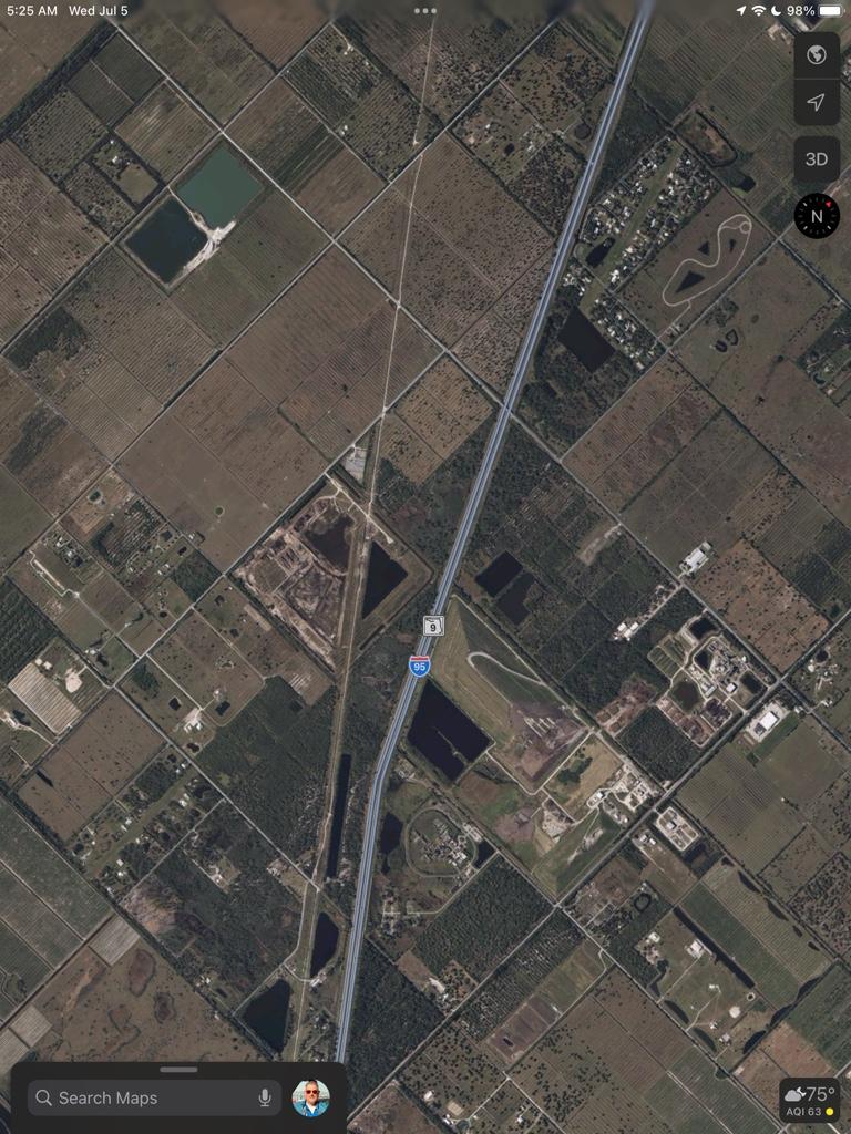
TLDR: pilot reports engine trouble "Partial power", turns to nearest airport. Can't make it there, makes a great forced-landing on an empty field with a road. Approach controller later reports they are in-contact and okay.

ADS-b:
https://globe.adsbexchange.com/?icao=a28db2

Live ATC is at 1900z on Huntsville approach:
https://archive.liveatc.net/khsv/KHSV-App-Dep-Jul-04-2023-1900Z.mp3

pilot declares about 3 minutes in (so about 1903z if the times are lined-up correctly). at 20-minutes into the recording ATC reports they are in-contact an EMS is on-site.
 
Last edited:
An absolutely textbook engine-out landing.

Look at the ADS-B trace, maintains ~90 knots all the way.

Even makes the 270-degree turn to line-up on a road.

I have to say this part is impressive: historically there's been alot of crashes where pilots "choke-up" on the final turn and stall/spin it in, but ADS-B labels show its ~90 kts the whole way thru the turn.
 
Last edited:
BTW: that "South Huntsville Airport" that appears on ADSbExchange map is _not_ marked on the Foreflight charts.
It's a grass field.
It is _not_ marked on the VFR chart, either.

If he had known about that, it was much closer option.
but without it being marked on the charts, there's no way to know a Grass-field private airport was only 3-miles away from where the pilot first declared trouble.

N26387_ADSb_Track.png

Edit: according to my measurements on ForeFlight Satellite map, the "South Huntsville Airport" as shown on that ADSb map is a grass field 2,200 feet length.

I can't find any other info about this place, its just somebody's private grass landing strip, otherwise unmarked on any aviation charts.
 
Last edited:
There's also an unmarked "Milton Airport" grass field 2,600 feet in length, just about 2.5 nm south of where he declares (the sharp turn from east to northbound).
It appears on my Glider Charts (XC Soar) but does not appear on Foreflight. That "Milton PVT" does appear on the sectional map (circle R) but otherwise has no airport information nor any waypoint associated with it in Foreflight.

The Approach controller never mentions these options either, likewise unaware of them. These "unmarked private landing strips" are scattered around most places, but you'd have to manually look around on Satellite imagery to find them. (and you cannot see Satellite image layer while "in the air" on Foreflight, requires data connection).

Edit to add:
Private airports will show in ForeFlight but you need to turn-on the option under Airports settings:
https://support.foreflight.com/hc/e...83-Why-am-I-not-seeing-an-airport-on-the-map-
This seems to take all the “circle R” symbols from
the Sectional and make them appear as dots in ForeFlight.

I totally forgot I had this filtered-out in my settings, so discussion on this incident had made me learn something new.

Not sure how much trouble you’d get from emergency landing on someone’s private airstrip, but hey… it can’t be any worse than emergency landing off-runway at a Military Base, huh ???
 
Last edited:
Finding a private grass runway among green areas is difficult and would be impossible in an engine out situation here in Florida. You have to look for the houses (like looking for hangars) in a sea of green. Then you bring in the possibility of hitting houses and runway overrun, Im thinking a large field or nearby road might be better.

There’s 2 in this picture:
20ad9a626f0350df3add3feef815dfa4.jpg
 
Seems a little low from what I see. If not local & familiar, just don’t see one looking at iPads & such for nearby grass fields, more of an ‘eyes-out’ scenario. Maybe he was higher when problem became known.

Yes, give me a few knots fast over stalling any day.
 
Just in case anyone thinks it's easy to find a grass strip around these parts. Here's a satellite image of the area. The star marks the spot where it appears he diverted.

The two grass strips are within this image.

From 1,500AGL, they'd be hard to find if you knew where they were and you were within 1/2 mile.

N26387.jpg
 
When the pilot makes the North turn to divert , ADSb shows at 3,400 ft. The ground elevation around here is 610-760ft. (This matches with the ADSb track takeoff from Huntsville showing 600 ft, them climb out.).
Let’s say.. by the time the pilot knows he’s in trouble and needs to make a dead-stick landing it’s 3,000 ft (he’s going north by this point), that gives approx 2,300 feet AGL to work-with.

re: finding a grass field among farm fields:
yes you are right, it’s hard unless you exactly know where it is, or have landed there before. I’ve been in this same situation with my Glider, and getting low below pattern altitude trying to find my home gliderport it looks a lot different being low and looking across the trees, I almost got lost once returning to my home gliderport, definitely looks different vs being high and looking down into the airport.

Fun exercise to try: some of these private grass airports have their runway directions available in ForeFlight: you can select them “direct to” then re-select the airport press “more” and “select runway” this gives you a marker indication of extended runway centerline so you can line-up onto it (which is the only way I’d try to do this, at an unfamiliar grass field). 4AL8 is the same “Milton Airport” shown on the other screenshots.

Keep in mind, your closest airport maybe behind you”. Edit to add: I also learn from this scenario that Direction of flight matters alot in an engine-out scenario, We can also see clearly from this ADSb data that a 270-degree turn costs ~1000 ft altitude, so even _if_ the pilot was aware of Milton Field and was familiar with it (unlikely) it’s not an easy decision to turn the whole plane around like that.


Of course, saying all this With the benefit of hindsight and extra time to examine this, “don’t read a checklist into the ground”.

IMG_0244.jpeg

edit to add:
Many local pilots here trained out of HUA and are familiar with it (there is an MWR Flying Activity there). Pilot reported HUA field in sight and he thought he had partial engine power to make it… not trying to second guess or criticize the valid decision he made; just playing the “What-if” game.
 
Last edited:
Adding more local knowledge context:
There’s alot of Restricted areas near here: R2104A and C is often “Hot” during weekdays / workdays at the Arsenal. Pilot was lucky they were cold (Approach controllers often warn us about these if they are active). Most local pilots here, and anyone trained at the MWR Flying Activity, would naturally always avoid these areas regardless of their status.

If the Restricted areas happened to be active that day, then there’s a lot more “what If” questions to think about.

R2104B (East side) is _always_ active, absolutely no entry at-or-below 2400 ft MSL.
 
Last edited:
Declaring an emergency helps with the restricted areas. :)
 
Declaring an emergency helps with the restricted areas. :)
Only with respect to FAA enforcement action and the Pilot Deviation.

there are dangerous things going-on in that space, or the surface, not waivered by an ATC emergency. Those hazards to aviation and your safety still exist. Once on the ground, the Military Police’s enforcement of security/no-go zone doesn’t care what ATC says.

Said another way: “the reason it’s restricted / hot / active” is still there and is still a hazard, whether you had a valid emergency to violate the restricted space or not. This is drilled-into the student pilots who take training at that airfield, that the military’s restricted areas are not to be trifled with.
 
Didn't click any links or listen to ATC.net ... if the pilot got it on the ground successfully, that's all that counts. Insurance bought that aircraft as soon as it started acting up. Messing around head down on Foreflight instead of "heads up" for a suitable landing site doesn't sound like fun ... and even if he is familiar with the area, it may be hard to spot as other users indicated.
 
Good job to the Tiger pilot!

I'm based at a charted grass strip and still can't find the thing when approaching from the east or west. I just aim for "it's about there between the church and a racetrack" until I get within a couple miles and can see the actual runway. It's also not in Garmin's database, and most of our local approach controllers don't know exactly where it is either.
 
Well nothing more acutely hazardous to your health than your engine stop working
Yeah , with your engine out and your only other option like some restricted area , say , under “live fire exercise” at the very same moment … I guess at that point you can safely say you were mean to go that day …
 
Awesome that he brought it in and are OK. Nice job.

As to the restricted stuff, I'd be much more worried about power lines than missiles or artillery, based on my read of NTSB accident reports.

As to grass fields, there are two around here I sometimes fly to. I can only find them by their relation to other landmarks, and that's knowing what they look like and having them on the tablet.
 
I work at Redstone Arsenal and I am familiar with that area.

He landed on the access road to the West Range complex on the Redstone reservation. That's a range where they test aerial rockets and MANPADS shoulder fired missiles..
 
He landed on the access road to the West Range complex on the Redstone reservation. That's a range where they test aerial rockets and MANPADS shoulder fired missiles..

Army guy: Hey guys.....lets practice hitting that grumman with no engine coming right for us..
Other Gen z army guy: Why not....lets have some fun..
 
Only with respect to FAA enforcement action and the Pilot Deviation.

there are dangerous things going-on in that space, or the surface, not waivered by an ATC emergency. Those hazards to aviation and your safety still exist. Once on the ground, the Military Police’s enforcement of security/no-go zone doesn’t care what ATC says.

Said another way: “the reason it’s restricted / hot / active” is still there and is still a hazard, whether you had a valid emergency to violate the restricted space or not. This is drilled-into the student pilots who take training at that airfield, that the military’s restricted areas are not to be trifled with.

If you declare and are headed through one, the controlling agency will be noticed and the activities will cease. It is not like the people using the area are not in contact.

Agreed that they not be trifled with, but also, don't crash because you don't want to enter restricted airspace after declaring.
 
Back
Top