Pbtx0
Pre-Flight
Does anyone have experience flying in and out of 0A7 in Hendersonville, NC? My in-laws just moved to the area and I am planning my first trip out there for Thanksgiving. The AFD indicates to use caution when winds get over 10 knots. Also curious as to what procedures people have used getting in and out in marginal VFR conditions given that the airport doesn't have an ODP or any IAPs. Any know what the MVA is and if ATC will allow approaches into Asheville with subsequent VFR approach into 0A7?
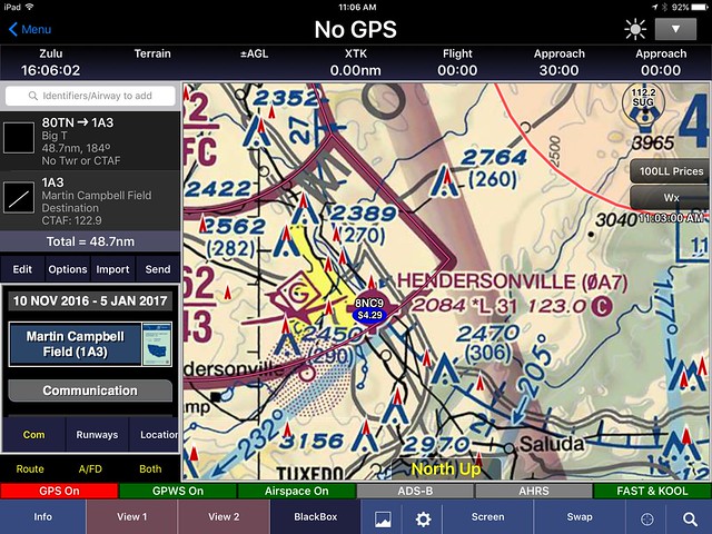


") However, 0A7 has a treeline east of the runway which is closer to the runway than I'm used to. That treeline had my attention and is probably another reason for the wind advisory.
However, 0A7 has a treeline east of the runway which is closer to the runway than I'm used to. That treeline had my attention and is probably another reason for the wind advisory.