JOhnH
Touchdown! Greaser!
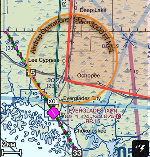
We are planning to fly to Everglades City (X01)for Lunch, but there is a fairly large TFR in the neighborhood. What would you do?
Cancel?
Circle around to the East for better wind conditions, even though that keeps us over the swamp longer?
Not worry about it?
(I tried to upload a screen shot of the route showing thr TFR but I keep getting a security error. Have I not reached a new minimum post requirement)
Cancel?
Circle around to the East for better wind conditions, even though that keeps us over the swamp longer?
Not worry about it?
(I tried to upload a screen shot of the route showing thr TFR but I keep getting a security error. Have I not reached a new minimum post requirement)
 Be cognizant of smoke in the area if the winds aren't favorable.