First long cross country and need opinion

jd21476

Line Up and Wait
Joined
Jan 17, 2018
Messages
693
Location
San Diego, CA
Display Name

Display name:
jd21476
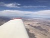
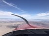
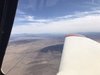
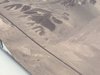
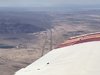
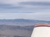
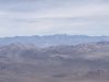
I am going to fly my first long cross country flight this Friday (or the longest I have done so far) and it will be VFR and solo. I am going to be flying from San Diego to Northern Nevada and returning the same route on Monday. I plan to file a flight plan and to use flight following along the route.

Please let me know if you see any flaws in my trip planning.

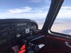
I will be flying my 1959 Piper Comanche 180, I am planning on cruising at 135 knots at 10,500.

For fuel, my plane holds 60 gallons and will burn about 9.5 per hour at cruise. Maybe a little less but I am calculating based on those numbers.

My route will be:

KSEE - VPLCP - KWJF - KMHV - KL361 - O26(stop for fuel) - KTMT -KWMC
Total distance is 516 miles and roughly 3.5 hours.

I can probably make the entire trip on one tank of fuel but I want to be conservative on my numbers and to have enough reserve at the end.
 
The only thing I'd question (being a flatlander from Florida) is: do you have experience flying at 10,500 for 3+ hours? If you live in Denver, probably not a problem. If you live at sea level (San Diego), be aware that while legal, flying that long that high can affect you.

Your planning looks conservative otherwise (which is good, IMHO).

John
 
I'd have similar reservations regarding the altitude. I haven't referenced FARs, but the Army would limit us to 2 hours 10,000' to 12,000', and 30 minutes from 12,000' to 14,000'. I've hung out at 11,700' (for a short duration landing on Colorado peaks), and the physiological affects of hypoxia is real. Starts with blue lips, then you can't add 2+2...
 
Not being familiar with the area, upload_2020-2-25_11-50-5.png here are the few items I noticed:

Altitude: It's not especially high but unless you are use to flying at higher altitudes, I agree with the others that 10,500 for the entire flight may be a bit much and even if it doesn't seem to affect you, can leave you more tired at the end the the flight, in what is probably the least familiar territory. Fortunately, you do not have to fly that high for the entire flight. You can change altitudes when you can.

Restricted Airspace. This is a local knowledge question. I know that some "continuous" restricted areas will let people through when hot when there is no current activity. How is R-2505 (China Lake NAWS) about that? The reason I ask is...

Mountain Lee Side. The mountainous area to the west of R-2505, especially the northern portion is substantially higher than the terrain to the east. That's a recipe for some leeward down flow and turbulence. If the westerly winds aloft at 9,000 to 12,000 are strong, we have at least the potential for significant turbulence and the potential for downdrafts exceeding climb capability. Knowing that going further east, say KIYK and being able to cross the restricted area northbound would be a nice planing buffer. Either way, the winds in that area is definitely something to consider as part of the final go-no go as well as something to monitor carefully in flight.
 

Attachments

  • upload_2020-2-25_11-49-15.png
    upload_2020-2-25_11-49-15.png
    107.8 KB · Views: 25
Last edited:
If your flying along and you slowly start to feel like your a great pilot and everything is perfect - it's time to beware. Hypoxia sneaks up on you in a very special way.

It's a wonderful feeling, like a gentle drug that slowly makes you feel wonderful. Right up until you pass out.

Everyone is different, but I start getting hypoxic around 10,000 feet.

I live in the mountains and recently bought a can of Oxygen. Not an oxygen system, just a can of the stuff that you can take a lung full of. I was surprised that it really helped for short periods at high altitude. Aviation website carry this stuff, I forget the brand name.

A long flight at 10.5 would be a no go for me.

A better choice would be to fly at 7.5 to 8.5 and only pop up to 10.5 when necessary.

One simple check for hypoxia is to keep doing some math problems in your head. If you have trouble multiplying simple numbers, it may be a sign to get down lower.
 
get a SPO2 monitor and go up to 10.5 and see your O2 level dip (or not) before you take the flight. myself and @Sinistar had some eye opening moments when we tried this and we went up to 12.5 for less than 20 mins. huffing and puffing on a handheld can didnt do us much good. we both invested in a O2 system for a trip which never took place
 
X2 on the mountain turbulence. Leeward side of the mountains can get really, really rough.
Look at the pressure difference between the windward side and the leeward side of the mountains. Every 10th of an inch of Mercury roughly equals 10 knots of wind. I would not be too excited about going with anything over 30 to 40 knot winds.
That being said, if you really want to have the mountain flying experience, go when the winds are high and you will definitely have an experience!
 
Good points raised about length of flight at altitude and the potential turbulence. Don't press it if the winds are up. I would consider using Tonapah (KTPH) rather than Lone Pine (O26) for a fuel/rest stop. You would have a significant climb to make out of Lone Pine to cross the ridge line on the east side of the Owens Valley in a short distance.
 
All good issues and I appreciate the responses. I am going to reevaluate my altitude for the trip. I was trying to fly higher to avoid having to dodge some of the mountains and to potentially burn less fuel but I did not consider the hypoxia issues.
 
Why so high?

Could do it at 8.5 or less
 
OP, when i got my plane i was a student and flew her from WA to ND, all of my first leg was at 10k for about 3.5 hrs, i didnt feel any hypoxia OR didnt know what to look for. i was also not the PIC... had a crusty old ATP as the PIC. since you will be doing this solo, if nothing get a SPO2 monitor to monitor your levels and take actions if it reads below 90
 
All good issues and I appreciate the responses. I am going to reevaluate my altitude for the trip. I was trying to fly higher to avoid having to dodge some of the mountains and to potentially burn less fuel but I did not consider the hypoxia issues.

With all of the tasks you'll be working on the trip, trying to save a few gallons of fuel should be pretty far down the list.
 
Just took a peek. What about scooting over near the Salton Sea, up towards Barstow, then continue on the leeward side of the terrain? Yes, you’ll have to adjust a bit if any special use airspace is active. The weather is ‘usually’ better East of higher elevations. I’d at least work up a secondary plan.
 
If you’re relatively fit, you can try a couple things for altitude...there are some great little mountains to run in Chula Vista...just shove a straw in your mouth and start jogging up. Or, run the soft sand between NAB Coronado and IB with a straw. You’ll find out pretty quick how you respond to oxygen depletion. The saturation at 10-11k isn’t bad (14%ish), about 1/3 less than at sea level (20%ish), but your physiology-namely, your red blood cell count-will largely determine how your body responds. I did some trail races between 10 and 14k on Colorado, and it was a crapshoot watching other people; I ran in Leadville 50 with a girl from San Diego who was crushing it, and saw a guy born and bred in the mountains who passed out on the run. Physiology + training goes a long way. If you don’t mind the taste of ship fuel in San Diego water, free diving is a great way to train for it as well.

Looks like a fun trip. Post some pictures.
 
As a SoCal/AZ person, the 10,500 doesn't bother me at all. If you don't have pulmonary issues, hypoxia shouldn't yet set in. YMMV.

Higher is better (within reason) to give you options if the mill were to shut down.

I know you know to watch the airspace just North of Gillespie, as the Class-B comes down to 1,800 just North of the airport. Work your way around/through as you have been taught.

Personally, I wouldn't choose your destination airport. It's awfully close to the Panamint Range, and all of Edward's restricted spaces.

I would turn from MHV and go to Fresno. Boring, I know.
 
The only problem I see is both a VFR flight plan an dFlight following. One or the other, both seem like overkill. Unless of course you can't get FF in the mountains, a distinct possibility.
 
OP, when i got my plane i was a student and flew her from WA to ND, all of my first leg was at 10k for about 3.5 hrs, i didnt feel any hypoxia OR didnt know what to look for. i was also not the PIC... had a crusty old ATP as the PIC. since you will be doing this solo, if nothing get a SPO2 monitor to monitor your levels and take actions if it reads below 90

I should mention that when I bought the plane I flew it back from Idaho but I had a CFI with me at the time.
 
The only problem I see is both a VFR flight plan an dFlight following. One or the other, both seem like overkill. Unless of course you can't get FF in the mountains, a distinct possibility.

I'm pretty sure I can do both and I like the idea of the flight plan because I may lose comms due to terrain, on the other side of that, I want FF becasue then I can possibly go direct if some of the Restricted areas are cold.
 
Get a good pulse ox meter, so that as your flying you can monitor your o2 level. Also comes in handy to make sure your not getting co from leaks you r not aware of.
 
I'm pretty sure I can do both and I like the idea of the flight plan because I may lose comms due to terrain, on the other side of that, I want FF becasue then I can possibly go direct if some of the Restricted areas are cold.
you can do both, i do when i am flying somewhere and i know radar coverage is spotty
 
I've flown in the 10,500-12,500 range for 2-3 hours at a time and it never bothered me YMMV. Search amazon or your local drugstore for a pulse oximeter, there are some for under $20 on amazon right now. IIRC, you are looking for a reading of 90+. The one or two times I saw mine below that I re-seated the thing on my finger and got a 90-91 reading.

From some cross country experience I've learned that regardless of altitude about 3 hours is when most adults are ready for a bathroom and a stretch. I plan flight legs accordingly. There's something about being in a plane that shortens one's endurance. Maybe the workload, maybe the vibration, or the cramped quarters. IDK but it just works that way, in a car I can go a good 5 hours without stopping. I'd say that is a bigger concern for a trip like this than fuel reserve- if I'm reading the rough numbers right you'd have more than an hour fuel reserve which is enough for my personal comfort zone.

One other note I'll add in here, in a big open remote area like that I'd carry some extra water, be on flight following or at least file and activate a flight plan, and carrying a PLB wouldn't be a terrible idea either.
 
I would add: Be prepared to alter your dates and/or get stuck. Hopefully where you are going (VFR) you have a nice wx weekend all along your route. Up here in the flat lands in winter it's almost impossible to have a Friday to Monday and have it flyable (VFR) on both dates....which means about 4hrs after you land you start looking at TAFs about every 4 hrs (which is not relaxing). And IFR wouldn't help because you'd also need FIKI.

Before my next 500nm trip I'm gonna get a Garmin InReach. I think a inreach + Flight Following is a better combo VFR flight plan + Flight Following. But that's not a cheap step.

Also, for oximeter I found I like the newest round of cheapo fitbit like clones that have HR and SPO2. They sample slower than a finger unit but it leaves both hands available. On my last flight to around 16K I would initiate a new sample about every 5 minutes while testing things out. If it were a level flight and not experimenting probably every 10-15 minutes or so.

Sounds like a great trip. Have fun and share some pictures.
 
Carry a snack and Gatorade. Over 3 hours for me and I get 3 issues. Hunger, thirst, and biological.

Landing while hungry, thirsty, or having to pee is distracting. Gatorade and the bottle it comes in serves for 2 of those problems.
 
I'd fly further east to for lower terrain and probably less hassle with ATC. Check this out: ksee hec jipem bty lidat ktph ktmt for gas and kwmc. I frequently fly part of this route from Palm Springs to the Reno area. I'm always at 11,500 to 13,500. At 10,500 you'll be skimming over a lot of mountain tops but it would work. Any of this 8,500 +/- advice is out of the question. To keep from getting screwed around by ATC, I'd skip FF until you get up toward BTY. Also, if you are in half way decent shape, forget all this business about lack of oxygen at 11,000.
 
HIFLIER- thank you for that route. I like that one and I think I am going to adjust my plans and run that route instead. I have a finger oxygen meter that I will monitor and I think Im fairly fit as I am active duty military, so, I may be ok.
 
The only change I think I will make is to stop over in Tonopah (KTPH) for fuel as opposed to Austin (KTMT) becasue then it is 336nm until a stop and fuel as opposed to 419nm BUT I may change it enroute depending on my fatigue, bladder and fuel reserves.
 
If you're young and fit, 10,000 probably is not going to be an issue, but you do live at sea-level. Just watch it, use O2 if you have it, or plan to fly the portions of the route that you can at a lower altitude.

I think your real concern should be winds in and around the Sierra, Owens Valley, and crossing the mountains in Death Valley (which are huge, by the way). If you see forecasted winds over, say 40mph at 15,000 near bishop or Olancha, I would seriously consider re-routing such that you go up the east side of the R-2502 complex (roughly KSEE 0O2 KWMC) and plan the fuel stop at Tonopah (which is a kinda cool place - a GIANT runway in the middle of the desert).
 
If you look at one of my posts above I am going to reroute to a route that hiflier proposed with a stop at Tonopah instead of Austin.
 
There is a storm blowing through this weekend here in the Great Basin (as usual), with impacts forecast through Monday. Looks like it switches to a north wind by then, so, you could have a fast ride home. You’ll probably get some turbulence, but, nothing like a west wind in the lee of the Sierra and all the ranges here. I’d suggest you read the area forecast discussions from the national weather service out of their Las Vegas, Reno, and Elko offices.
 
I don't find flying at 9,500' or 10,500' a big deal. Have you been up at higher altitudes much before? Hiking or skiing?

I live in Atlanta, so ~1,000' MSL, so not high, but not sea level either. We used to go skiing at Breckenridge regularly and bottom is 9,700'. One of our daughters got some mild altitude sickness (headaches), so we switched to Park City / Deer Valley where the tops are ~10,000'. My wife and I have been back since, as the kids are older and on their own now.

Everyone is different.

Last year in Peru, Cusco at 11,000'+ didn't bother me. I could tell it was more effort to walk up hills. Some of that is they were steep and some of that was the altitude. But in Puno at over 12,500' seemed to be higher and more effort at times; walking around on flat land was still ok. My wife and I did have to stop for a minute or two to catch our breath when hiking on Taquile (island in Lake Titicaca). We had to stop on the trail, before we got to the top. Part of that I think was sitting in a seat on the boat for 45-60 min, then getting off the boat and immediately hiking up a hill, but a big part of it was it was just higher than my body is accustomed to. Later on we didn't have that issue walking around Taquile, although that was flatter with gentle slopes.

At some point it gets you. And it can sneak up on you.

Just something to think about.
 
I went to a retreat in Colorado at a Young Life camp (don't remember the name). It's around 10,000 feet. I took a 45 minute stroll after lunch the first full day I was there. I do mean a stroll-I was in no hurry and it was mostly flat where I walked. I didn't have any cognitive issues that I noticed, but my energy was sapped for the rest of the day. But I live at around 100' elevation MSL.
 
I don't find flying at 9,500' or 10,500' a big deal. Have you been up at higher altitudes much before? Hiking or skiing?

I live in Atlanta, so ~1,000' MSL, so not high, but not sea level either. We used to go skiing at Breckenridge regularly and bottom is 9,700'. One of our daughters got some mild altitude sickness (headaches), so we switched to Park City / Deer Valley where the tops are ~10,000'. My wife and I have been back since, as the kids are older and on their own now.

Everyone is different.

Last year in Peru, Cusco at 11,000'+ didn't bother me. I could tell it was more effort to walk up hills. Some of that is they were steep and some of that was the altitude. But in Puno at over 12,500' seemed to be higher and more effort at times; walking around on flat land was still ok. My wife and I did have to stop for a minute or two to catch our breath when hiking on Taquile (island in Lake Titicaca). We had to stop on the trail, before we got to the top. Part of that I think was sitting in a seat on the boat for 45-60 min, then getting off the boat and immediately hiking up a hill, but a big part of it was it was just higher than my body is accustomed to. Later on we didn't have that issue walking around Taquile, although that was flatter with gentle slopes.

At some point it gets you. And it can sneak up on you.

Just something to think about.

We did that same trip last year and while I had a similar experience as you, my wife was feeling the effects really badly after landing in Cusco, with a terrible headache and nauseous for the first three days. She's the one that runs 5k and 10k races while I wait at the finish line because I'm out of shape, so everyone reacts differently I guess.
 
The only thing I'd question (being a flatlander from Florida) is: do you have experience flying at 10,500 for 3+ hours? If you live in Denver, probably not a problem. If you live at sea level (San Diego), be aware that while legal, flying that long that high can affect you.

Your planning looks conservative otherwise (which is good, IMHO).

John
I live in Denver and after a few XCs, I realized that even living at 5280 for years, I needed O2! After a 90 min flight, I was more tired than expected and often a headache. Turns out there was a small leak in the exhaust system and CO was coming in - not much, just enough that I had a headache after landing. Overhauled the exhaust system, headache gone. But being tired didn't go away.

My normal cruise altitude is 9500-10500, same as the OP. Bought an O2 system and use it 1) any flights over 2 hours regardless of altitude, 2) all flights at night (unless just stop & gos at home airport to get night current), 3) any flight above 10.5 for more than an hour. The "can of O2" may help for a short period but that dependable 8 hr tank in the back seat is on my required equipment list when traveling. I consider it an insurance policy.
 
I feel you’ve gotten a lot of good advice, although not familiar with the route, I do a lot of long xcountries in the mountains(southeast New Mexico to San Juan islands) as well as Phoenix and Albuquerque. Weather, weather, weather, especially without an IFR rating and a normal aspirated 180 Comanche. I owned and learned to fly in one and loved the plane. It is underpowered and at 10,500, you will be sacrificing a lot of performance, ie hanging on the prop. 135 kts is optimistic at 10,500. If I have a good tail wind, no problem, but headwinds/downdrafts will be another story. As much of the flight as possible I would stay lower if I had any headwind. If big tailwind, I’d climb and enjoy. Turbulence is a game changer so fly early. Turbulence with a tail wind? Throttle back and enjoy, but it’s another story with headwinds, you can’t throttle back with the speed you will get at 10,500. Now a 400 Comanche is made for 11-12t. Good luck.
 
I don’t understand the comments that flight plan + FF is too much.

Student pilot over mountain ness desolate terrain. Flight plan (likely required by CFI) is the “right way” to do it and can result in S&R is he loses comm.

FF is the most practical for calling out conflicts and having an immediate ear who knows who and where you are if there’s trouble.

I don’t see this as overkill. This is the way to do it.
 
So I flew the route today at 9500’ and popped up to 10,500’ for a short period to avoid terrain. I had my O2 sensor with me and the lowest I got was 91.
 

Attachments

  • ECEEE66D-77B7-40EC-98C4-D27AFD9F29E6.jpeg
    ECEEE66D-77B7-40EC-98C4-D27AFD9F29E6.jpeg
    63.5 KB · Views: 29
  • 19AF439C-44EB-4AE9-B6B5-FDE341EBD5F2.jpeg
    19AF439C-44EB-4AE9-B6B5-FDE341EBD5F2.jpeg
    58.1 KB · Views: 25
  • 43196403-02DF-40EA-8270-268ECF708E37.jpeg
    43196403-02DF-40EA-8270-268ECF708E37.jpeg
    54.4 KB · Views: 23
  • 0D318992-7E48-4C0A-B4EE-50ED56D31CA6.jpeg
    0D318992-7E48-4C0A-B4EE-50ED56D31CA6.jpeg
    71.9 KB · Views: 26
  • 879D2985-4128-4774-B0CD-8D48E61D7E92.jpeg
    879D2985-4128-4774-B0CD-8D48E61D7E92.jpeg
    83.3 KB · Views: 27
  • BE8114C9-97BB-4B41-999C-5AE9EE216129.jpeg
    BE8114C9-97BB-4B41-999C-5AE9EE216129.jpeg
    70.5 KB · Views: 25
  • 441B8A1F-C023-4167-AAAF-421FFAC95C7E.jpeg
    441B8A1F-C023-4167-AAAF-421FFAC95C7E.jpeg
    49.6 KB · Views: 25
  • 3EE8F51B-BFBD-49C9-9E4E-E04884ECE547.jpeg
    3EE8F51B-BFBD-49C9-9E4E-E04884ECE547.jpeg
    52.7 KB · Views: 26
  • FEC6BCBF-254F-4D95-B0AB-F9C046F07149.jpeg
    FEC6BCBF-254F-4D95-B0AB-F9C046F07149.jpeg
    62.9 KB · Views: 26
  • 3AC49F7B-0B10-4AA6-8093-0D6B49275891.jpeg
    3AC49F7B-0B10-4AA6-8093-0D6B49275891.jpeg
    51.2 KB · Views: 28
Mission accomplished. Well done!
 
Back
Top