Anybody know of a good online aviation radius map?

BrianNC

En-Route
Joined
Feb 2, 2009
Messages
2,971
Location
Atlanta
Display Name

Display name:
BrianATL
I've found some, but the map isn't a sectional. Anybody know of one that uses a sectional to determine how far a distance is from the airport you're flying out of? The full radial circle around an airport? Can you do this on SkyVector, Airnav, etc?
 
Airnav has a blank to fill in to find distance to the airport on that page. Lower right side of page.
For first look at weather inside a set of radii I use Avnwx.com. You could cross reference with sectional available on Airnav?
 
Airnav has a blank to fill in to find distance to the airport on that page. Lower right side of page.
For first look at weather inside a set of radii I use Avnwx.com. You could cross reference with sectional available on Airnav?

Yeah, I know about that. I want to see a full circle around the airport for the distance.
 
Like this but on a sectional.

Screen%20Shot%202017-05-28%20at%206.53.24%20PM_zpskufyx31h.png
 
Use Distance Rings on Foreflight? Or, in WingX, just move the map and it always displays the distance between your location and the cursor.
 
Use Distance Rings on Foreflight? Or, in WingX, just move the map and it always displays the distance between your location and the cursor.

I have WingX. Bought it on a really cheap sale for a year but haven't used it as I haven't been flying. I'll try and figure that out. Thanks.
 
Why not just draw one yourself? That's what I did years ago. Ask to borrow a kid's protractor, use the scale on the chart, and BOOM! Done.
 
Why not just draw one yourself? That's what I did years ago. Ask to borrow a kid's protractor, use the scale on the chart, and BOOM! Done.

I need to buy a chart. Haven't bought one in years. That's why I was looking for something online. lol.
 
maybe u should rephrase ur question to "anyone know of an online tool that I happen to belong to that does what I want?"
 
I need to buy a chart. Haven't bought one in years. That's why I was looking for something online. lol.

So order a sectional online or check your local airport. Less than $10. Do it yourself, not everything has to be custom store bought.
 
I really like the flight planner on skyvector. Put in a source and destination and it clearly shows the route and distance. You can put in way points and routes.
 
I really like the flight planner on skyvector. Put in a source and destination and it clearly shows the route and distance. You can put in way points and routes.

Yep. I use that a lot.
 
I have WingX. Bought it on a really cheap sale for a year but haven't used it as I haven't been flying. I'll try and figure that out. Thanks.
If you are new to WingX you should watch the WingX videos on YouTube so you will know how to take advantage of all the neat features it has. There is also a good users manual that one of our POA members created. Maybe Scrabo will come along and post a link. I'm on my iPhone and don't have the link on it.
 
I've found some, but the map isn't a sectional. Anybody know of one that uses a sectional to determine how far a distance is from the airport you're flying out of? The full radial circle around an airport? Can you do this on SkyVector, Airnav, etc?

Brian, I just use the flight-plan feature on my tablet, or the finger "caliper"distance feature.
 
Try the demo version of iFly GPS. A two finger touch will display distance between the chosen point, and the second point, whicj can be moved as needed. Also there is a compass rose around present position which has the size noted on it. This changes with zoom level but is useful for a quick estimate of position by zooming in or out.
 
What's the purpose of the request? Range rings on several products listed above would work nicely for short distances. Maybe, <200 miles.

But if it's much longer than that, the shape of the "ring" is all about the projection you're using for your map. A circle will get more and more wrong as the range gets bigger. If you're looking for an endurance ring for anything with any legs at all, you'll want something more specialized. Unfortunately, I don't have a place to get one off the top of my head.
 
What's the purpose of the request? Range rings on several products listed above would work nicely for short distances. Maybe, <200 miles.

Just a quick way to see what airports are outside of a particular range, such as 50 miles for XC or 250 miles for the commercial long XC rather than just having to search the distance of one airport at a time.
 
Has anyone found anything worth while yet? I have been wanting the same thing, so that I can put in a radius to see what airports are within flying range to visit. Like for a cross country flight. Before anyone mentions using a paper sectional and flight planner...again.. yes I get that, but I want something on my computer. Skyvector and Airnav dont have that feature.
 
Why not just use the sectional map on any of the EFBs and expand and contract the size to match your desired radius? Granted the corner areas will be a bit outside the radius, but I’ll bet you can figure that out.
 
Why not just use the sectional map on any of the EFBs and expand and contract the size to match your desired radius? Granted the corner areas will be a bit outside the radius, but I’ll bet you can figure that out.

That works if you live at the airport. :D

I drive an hour to the airport I fly out of so it's basically useless for that. Unless there's some way to move them I don't know about.
 
That works if you live at the airport. :D

I drive an hour to the airport I fly out of so it's basically useless for that. Unless there's some way to move them I don't know about.
WingX and I suspect other EFBs allow moving the center of map wherever you want it (snap to center turned off)
 
Google Earth.

Center your home airport. Click on the Ruler. Click on Circle. Click on your home airport and drag out to the radius you want. In the search box, enter "Airports".

You might have to zoom in and out within that ring to be able to display some of the smaller fields that don't show up right away at larger viewing areas.


edit:

I use Avare on my tablet, it has 2/5/10 mile rings. But those aren't the rings you are looking for.

There used to be a website that let you do that, can't remember what it's called now. They got shut down because of some trademark or patent deal. You could pick an airport, then put in a distance, and it would return all the airports within that radius that met whatever criteria you entered.

edit/edit:

You can "save" that ring. Then you can bounce around inside it and double-click on airports to bring up their info without resetting it.
 
Last edited:
Back in the dark ages before the days of following the magenta line, I had a large aviation chart on my office wall. Part functional, part conversation piece. I put a string pivoted on my home airport and then through an eye. I carefully and neatly marked a scale. I could move the string to a potential destination, hold it with my fingers, then move that part of the string to the scale and see the distance. This was not my own idea. In most airports in those days there was a similar map on the wall. Simple and stationary, but very handy.

As far as accomplishing the same thing with an iSomething, with a small amount of practice on any EFB software package you can get a distance to potential destination in about two heartbeats. Just load up your favorite and poke around a little bit.
 
We’ve got one at our FBO. Covers about half the country. Endless $1000 hamburger idea generator.
 
You can use Skyvector. It takes some time but it works... (the same method works with foreflight too)

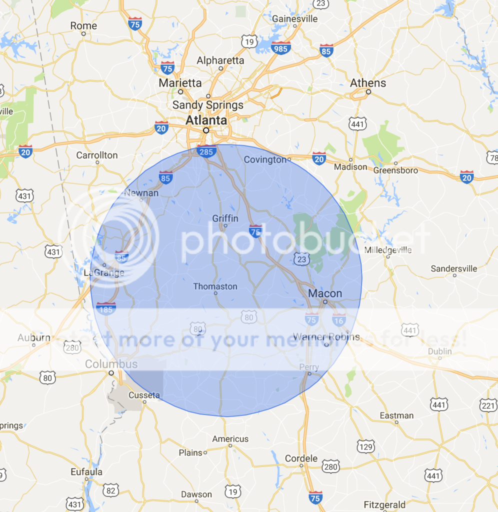
Lets say I was looking to do a 50NM radius around airport Philadelphia international

Go to flight plan mode. Put KPHL airport in as the origin and destination. In the “route” section you can put KPHL360050 to get the point that is due north and a distance of 050nm from KPHL, next waypoint do KPHL010050 and continue in 10 degree increments until you reach 360 again.

If you want you can also have it draw out concentric circles for other distances by just continuing to add points at further distances.

You can use whatever heading increment you want depending on how coarse/fine you want the circle to be and how much you want it to look like a circle; I find 10 degrees works fairly well though occasionally if I have an airport on the line, when I measure it, it comes up short (especially as you get further out and as the airport gets closer to being between the 2 heading based fixes) but 10 degrees increments make it real easy to do a find/replace in a notepad on all 37 waypoints (360 is entered twice) and extend the distance as I can search for 0<old distance> (0050) and replace it with 0<new distance> (say 0100).

You can also use any waypoint point you want as long as it has an identifier that skyvector is aware of (airports, VORs, intersections, non-intersection waypoints, VP waypoints, etc).

I'll use the feature for distance when calling up a tower and am told to report "X mile final" I'll create a quick flight plan from "current location" to Airport, Runway Reciprocal Heading and distance and finally the airport

So if I were landing 09 at KPHL I'd put in KPHL270010 for a 10 NM final to 09.

There’s also ways to log a change to altitude or airspeed enroute.
 
Last edited:
Here's a screen shot of 2 concentric circles at 50NM and 100NM around KPHL using skyvector.

upload_2019-5-19_16-9-47.png


I'll even be nice and provide the waypoints used for the first circle:
KPHL360050
KPHL010050
KPHL020050
KPHL030050
KPHL040050
KPHL050050
KPHL060050
KPHL070050
KPHL080050
KPHL090050
KPHL100050
KPHL110050
KPHL120050
KPHL130050
KPHL140050
KPHL150050
KPHL160050
KPHL170050
KPHL180050
KPHL190050
KPHL200050
KPHL210050
KPHL220050
KPHL230050
KPHL240050
KPHL250050
KPHL260050
KPHL270050
KPHL280050
KPHL290050
KPHL300050
KPHL310050
KPHL320050
KPHL330050
KPHL340050
KPHL350050
KPHL360050


Modify your way point and distance to your hearts content.
 
Wow! Before it got knocked out of business a couple of years ago, RUNWAYFINDER.com did this in 2 seconds:mad:
 
OK, it's been a few years. Does anyone have a free online tool that will do this currently?

Not sure why people were confusing the question. It's the same idea as the string on an old sectional hanging on an FBO wall, just digital.
 
Google Earth.

Center your home airport. Click on the Ruler. Click on Circle. Click on your home airport and drag out to the radius you want. In the search box, enter "Airports".

You might have to zoom in and out within that ring to be able to display some of the smaller fields that don't show up right away at larger viewing areas.
Nice, I never noticed the circle tool before (sectional chart downloaded from the FAA website).

1708382443912.png
 
That is pretty nice. I only see TIFFs on the FAA website. Is that what you imported? I can't seem to get that to work and I'm not finding a KML/KMZ.
 
Now we just need one that allows inputs of TAS and WA to show the shape that our range would be.
Already done?
 
Back
Top