denverpilot
Tied Down
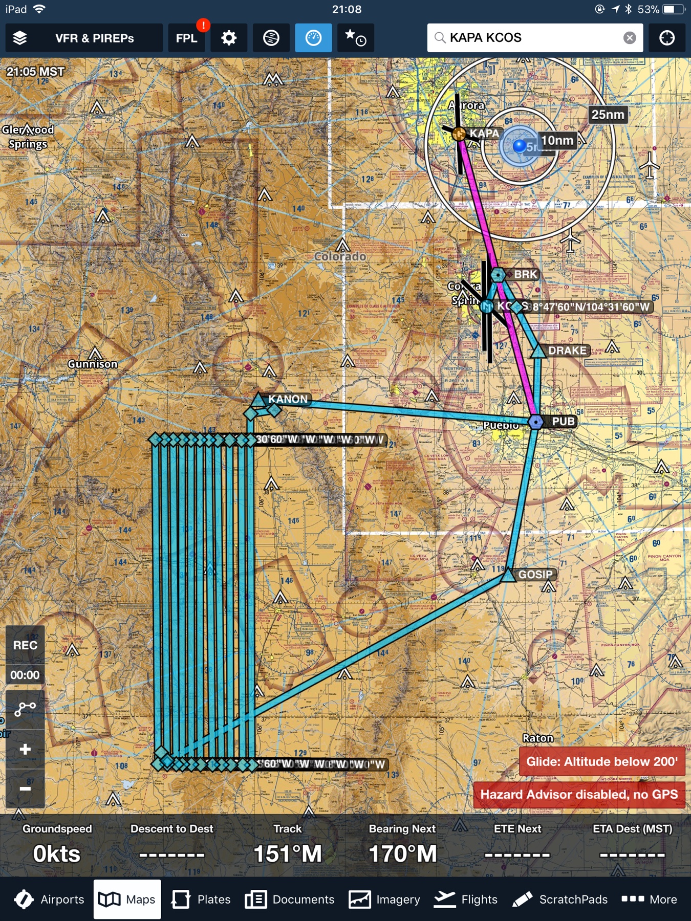
Playing with ForeFlight this evening, and noticed this “historical” IFR clearance between KAPA and KCOS.
Says it was a turboprop at FL220.
Says it was a turboprop at FL220.
Maybe I missed it on my phone screen but got an N#? It's a pretty small industry if I got a tail I could probably make a better guess what they're doing.
That's what I used to do.
")
Absolutely, in turbocharged piston twins and singles. I didn't like to see those jobs come in. I would much rather buzz around below the hills.Heh. I know. But probably not at FL220?
Absolutely, in turbocharged piston twins and singles. I didn't like to see those jobs come in. I would much rather buzz around below the hills.
Eleven tracks covering what? about fifteen miles? Two to three miles above the terrain...is that enough overlap for 3-D work? Or are they just looking for grow houses in the hills? The state used to do that at night over Park County.Interesting. That’s a really narrow sensor or lens setup to use tracks that close together from the lower Flight Levels.
The 60% overlap needed for photogrammetry is along the line. The side overlap only needs to be about 30%. It's hard to say what their AGL altitude was, but if it is 10,000', then the scale of the negative would be 1"=2000' with a 6" focal length lens (standard for photogrammetry). So a 9" wide negative would cover 18,000'. With 30% overlap, the distance between lines should be 12,600' or about 2.4 miles.Eleven tracks covering what? about fifteen miles? Two to three miles above the terrain...is that enough overlap for 3-D work? Or are they just looking for grow houses in the hills? The state used to do that at night over Park County.
Yep, surveying/mapping mineral deposits. Wether for oil/gas or gold I couldn't speculate. There's both in that section of CO.They were imaging rocks, lots of rocks.
What kind of geophysical stuff is at FL220 / 10k+ ft AGL? Not calling you a liar just curious as someone in the mapping industry. All the geophysical stuff I'm familiar with is flown at basically treetop level with stuff like Caravans and Twotters.Yep, surveying/mapping mineral deposits. Wether for oil/gas or gold I couldn't speculate. There's both in that section of CO.