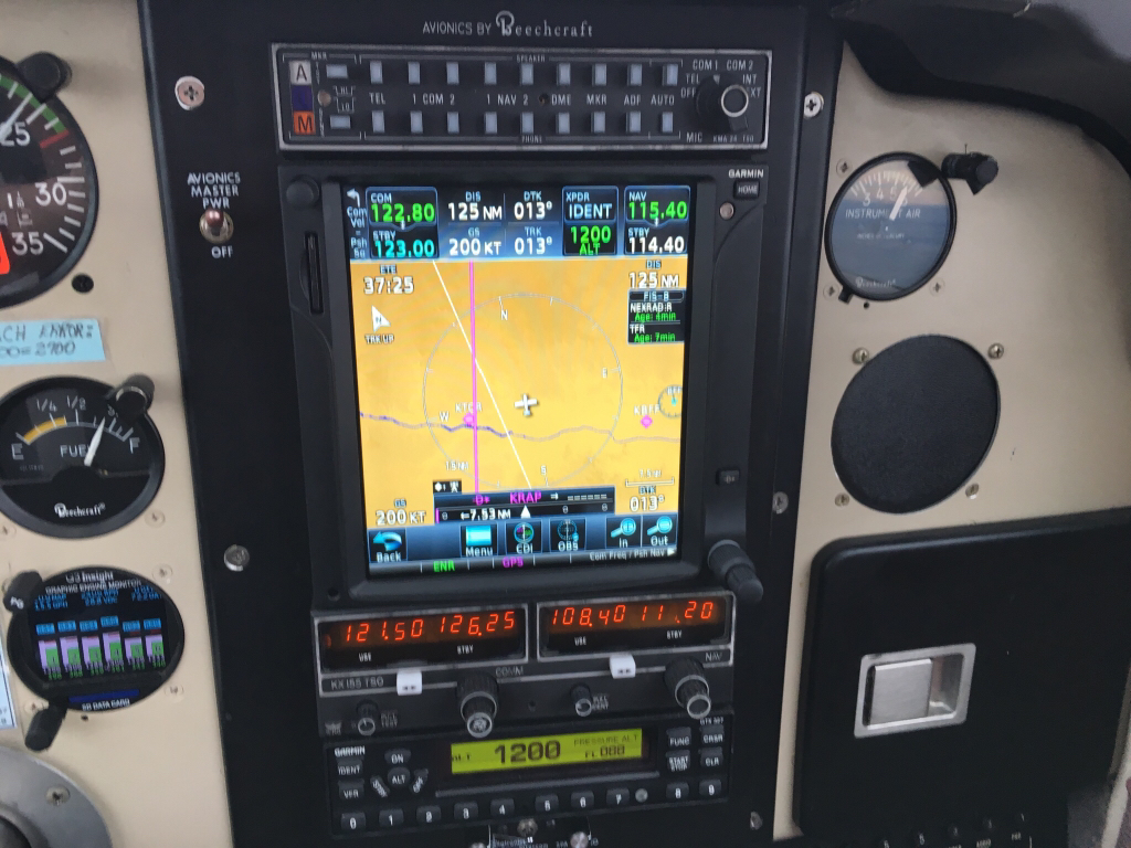
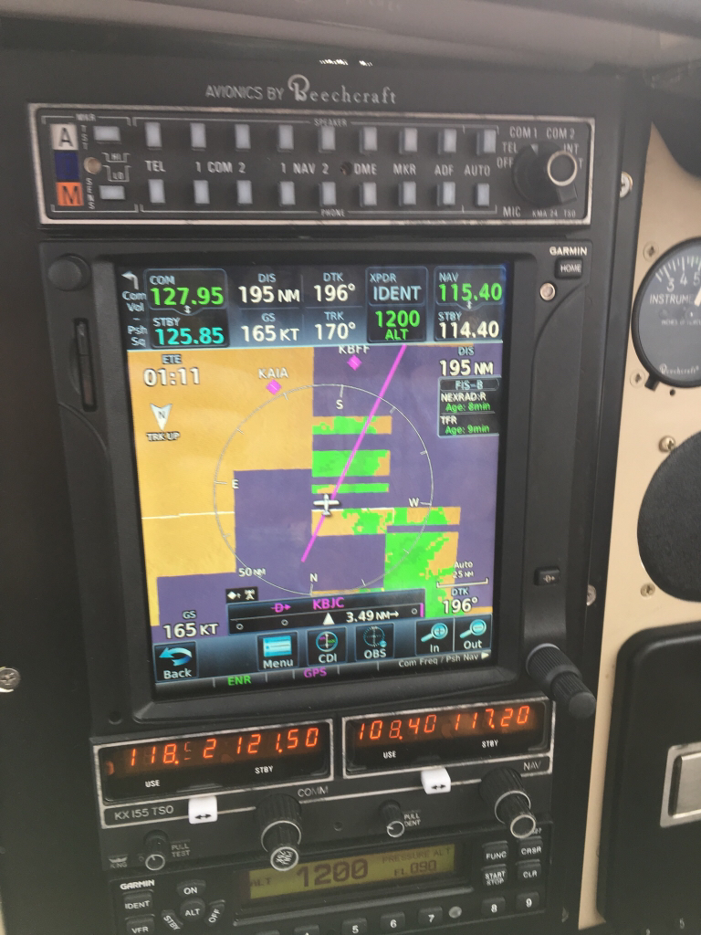
What made me scratch my head was that this occurred on my return from KRAP-KBJC in the afternoon. The morning trip KBJC-KRAP didn't display that.
Depending on time of day, as the (two) towers at DIA (I'm assuming by your flight route that's the towers you were likely getting your uplink from once you were in CO) *could* get overloaded with traffic uplinks, so less weather data will be interleaved than during slow times.
If you were further north, I'd have to go look up where the towers are, but it wasn't as likely to be traffic overload.
Weather is provided as secondary service behind traffic, which is why the whole (broken) concept of the "hockey puck" is in there in the first place. Assuming no one would be receiving who didn't have "OUT" was the engineering design, which is truly awful for a safety system, but they wanted more uplink time for weather and other secondary services.
Anyway... I can tell ya on ForeFlight and with the logs from a Stratux how to see why you're not getting weather blocks, (Stratux can be a great tool for troubleshooting the system overall, but since it's not on the same antenna or receiver as the Garmin, a debugging data-capture from the Garmin would be better, but I'm unaware of a way to get the Garmins to do that yet), but don't know where to dig into Garmin menus to see that data.
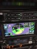
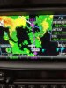
Garmin made the empty blocks a color instead of black so pilots wouldn't be lulled into thinking that's an area of no weather.
Some displays don't do that and it's just "not there" which can be a dangerous way to depict missing radar data.
The blue is distracting to me, I'd rather they did that with a light crosshatch like many graphical systems already use as a pseudo-standard for "no data". The blue blocks are too "in your face" for missing data, but I "get" why they did that.
Maybe it's configurable. Will be able to play more in December! ;-)
The interesting part about the traffic uplink time vs secondary data to me, is that FAA says only 1/4 of the fleet that's expected to be going ADS-B is equipped at this point. A 75% increase in targets to uplink isn't a small data problem and it'll be worse around major hubs.
I also know of no way for the system to not show a "black hole" for traffic data (not weather) when a tower site goes down. Which is a whole different problem in the design... in fact you'd still be receiving direct traffic that has Mode-S so you'd see an "area" that looked like it had "less traffic overall" but the only way you'd know that was because of a 978 uplink failure would be to see if you're receiving a tower. And I suspect most receivers will say you're receiving a tower just fine if the tower site loses its terrestrial data path but the transmitter is still on-air.
It's a very messy data delivery design for something intended to be used in real-time.
For us geeks. Just assume everything you see on the screen was transmitted to you with UDP instead of TCP over a radio link that has coverage holes. Let alone transmitted with a real Ack/Nak confirmation. Spray and pray.
That's about as far as you can really trust it. LOL.


")