Jamie Kirk
Line Up and Wait
- Joined
- Aug 7, 2018
- Messages
- 631
- Display Name
Display name:
JamieK
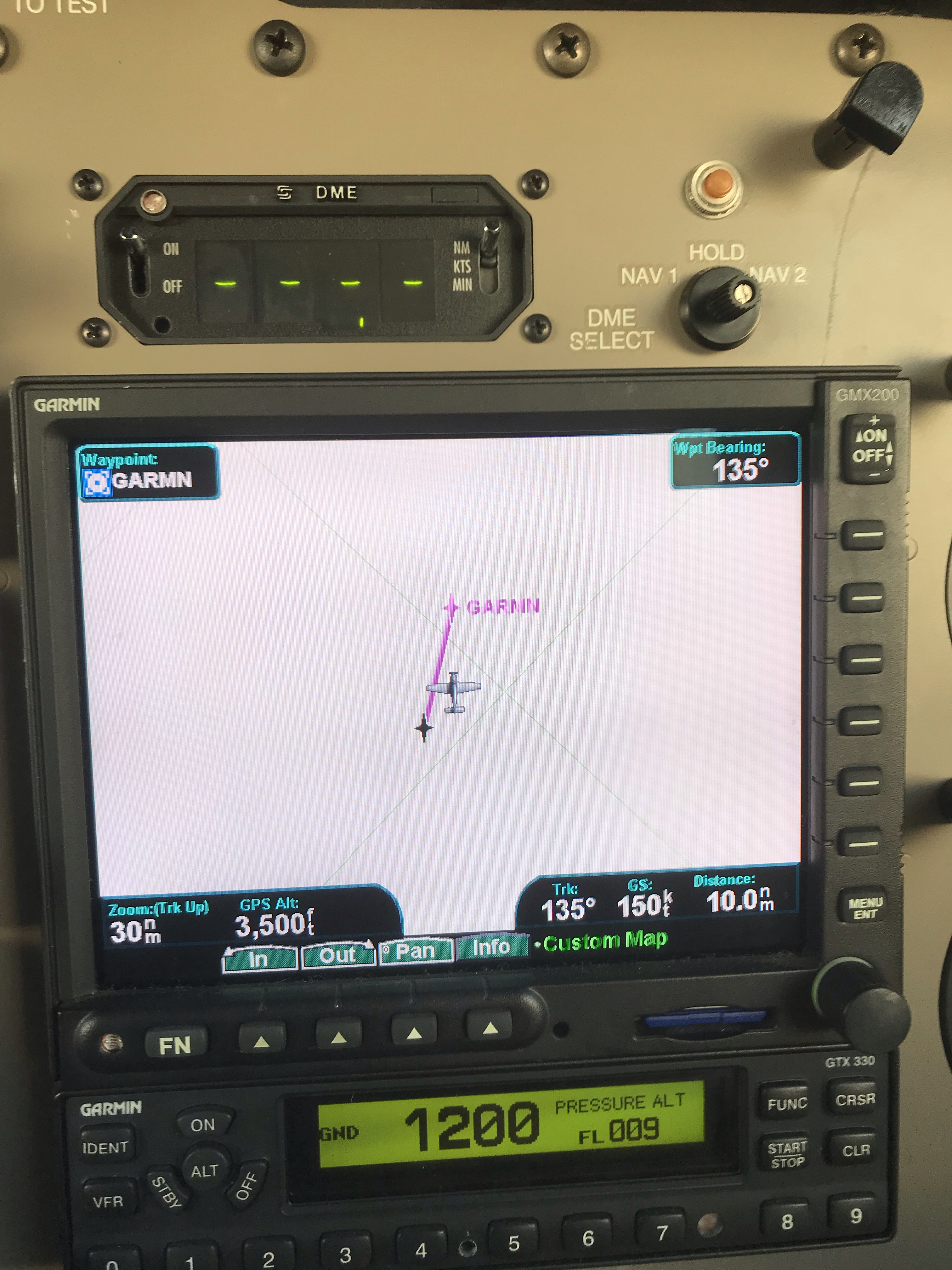
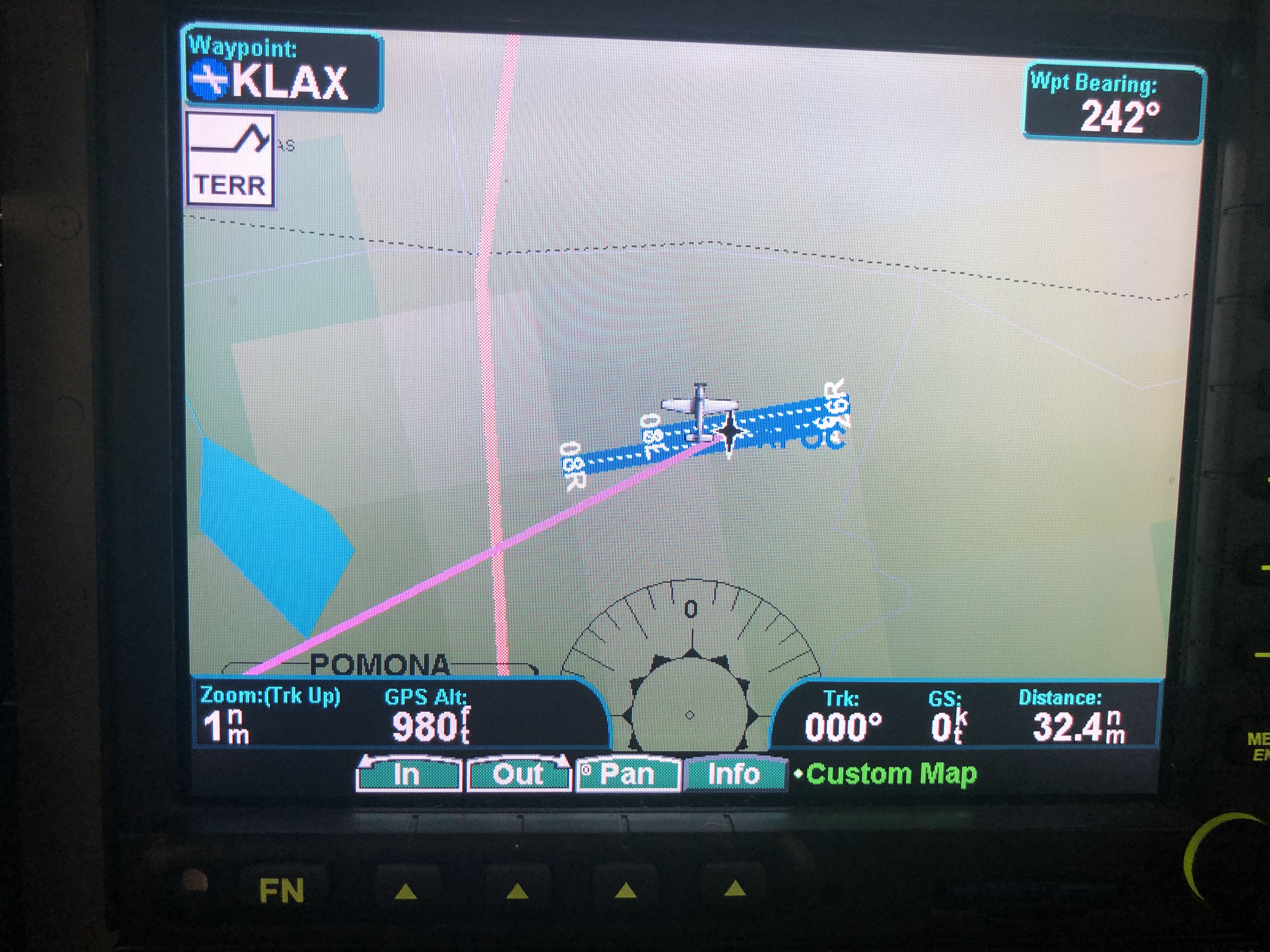
Is there a way to display your location on the moving map of the GMX200 without having a flight plan put into the 430W?
No, not unless it has it's own gps sensor installed.
My MX200 shows my location at all times.
Linked with a 480. Not sure what difference a 430 makes.
Might require a configuration tweak by your avionics shop. If not your position, what does it display when in Map mode?
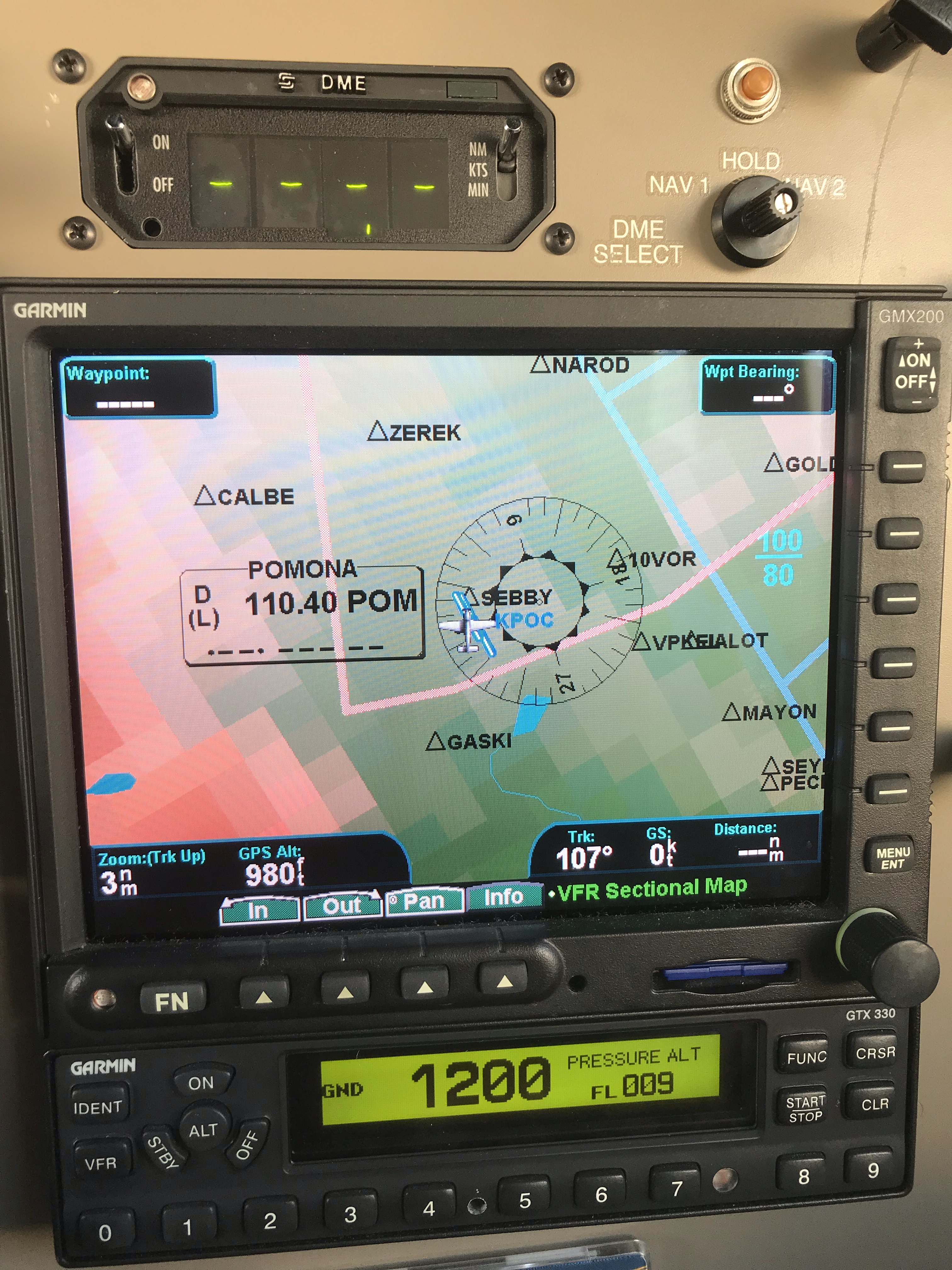
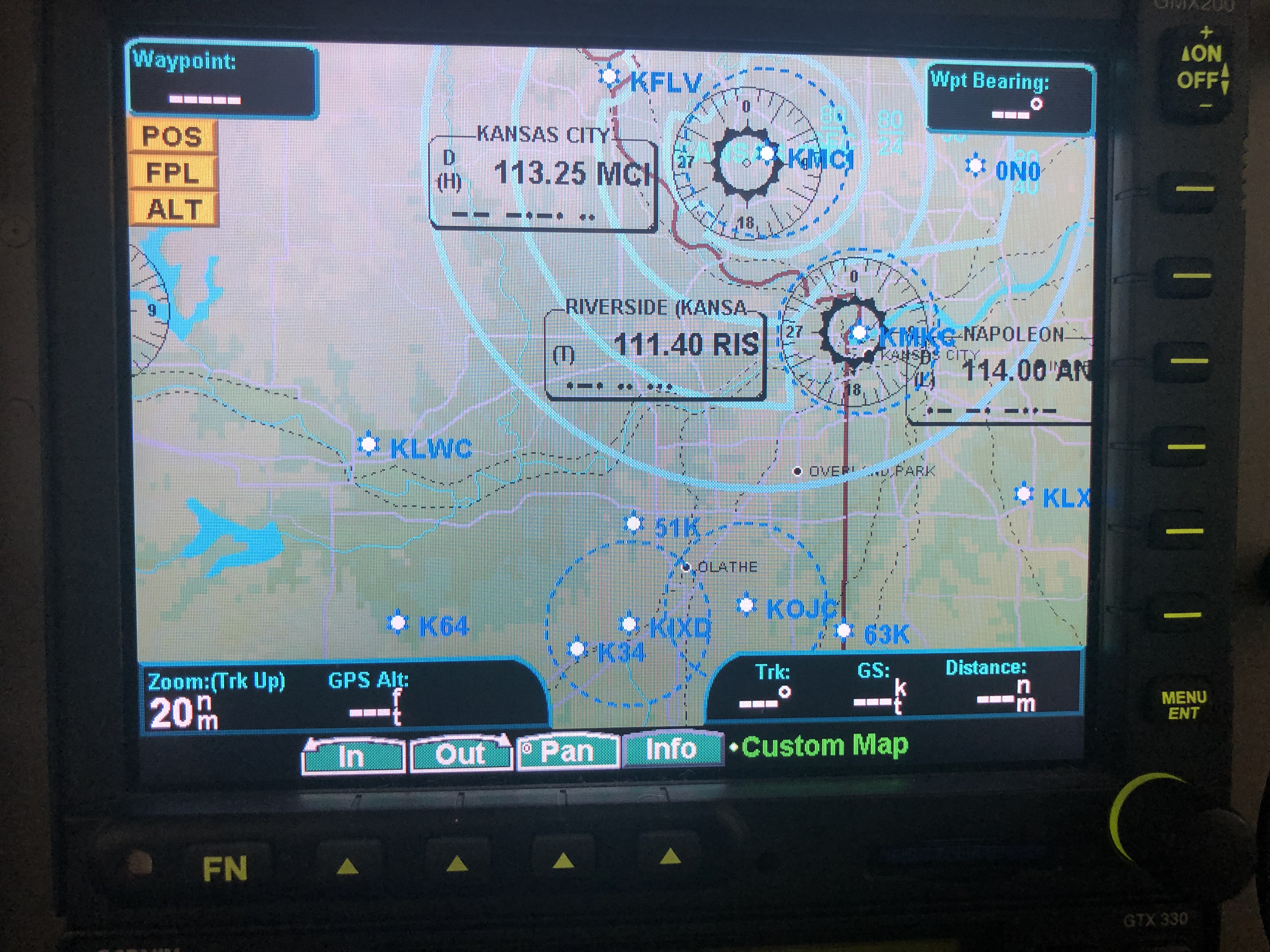
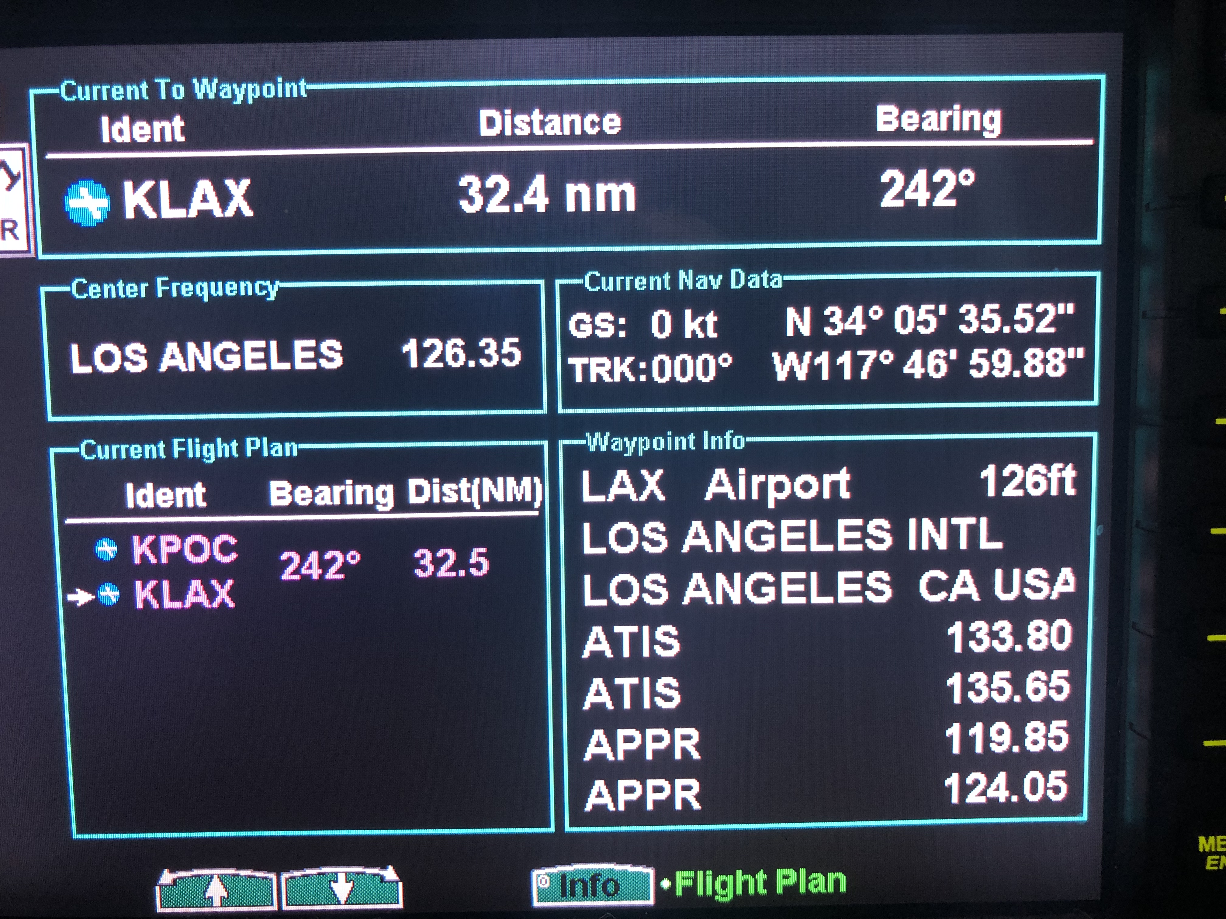
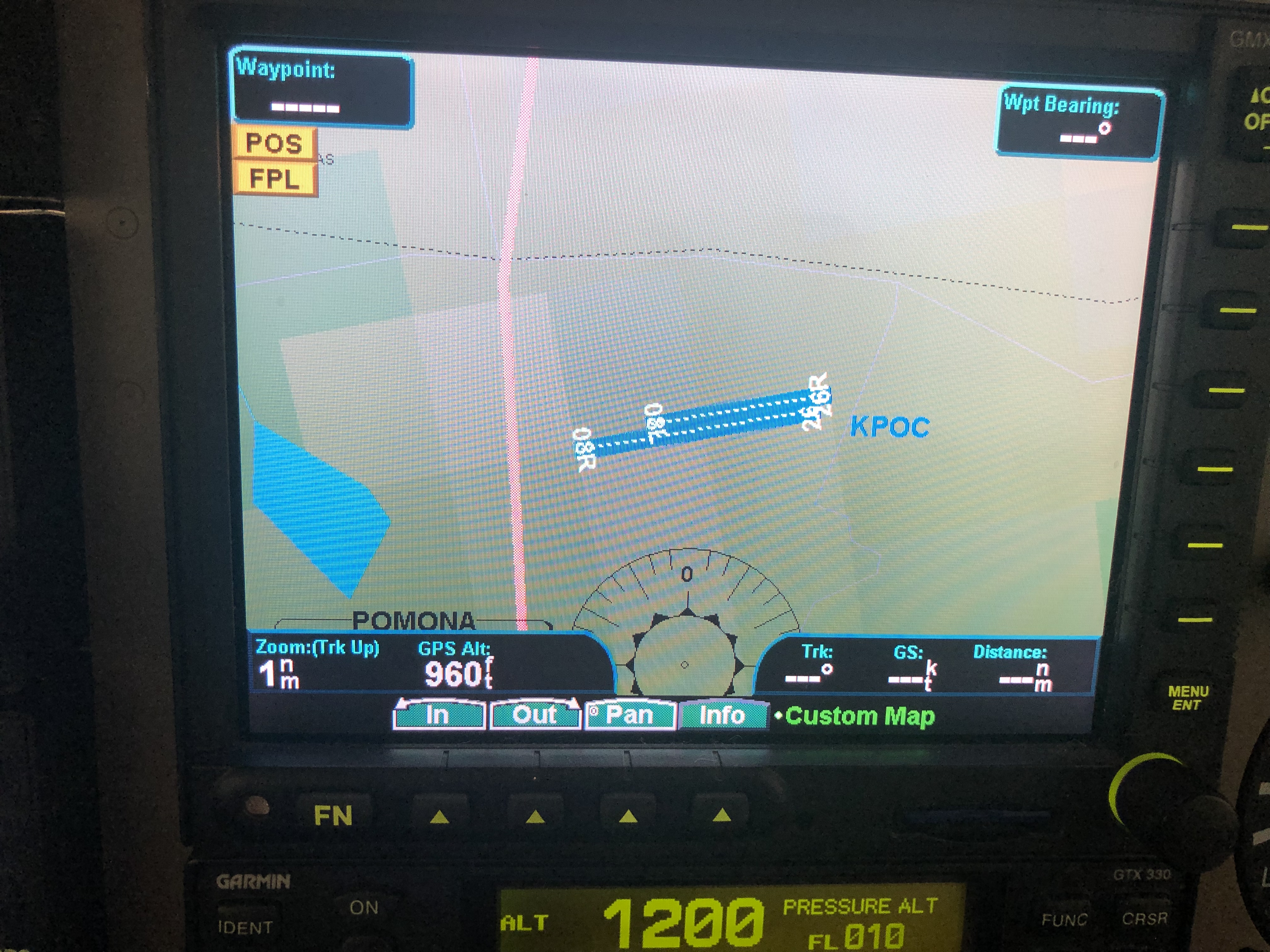
In map mode it shows random airspace in Kansas. I’m in California.
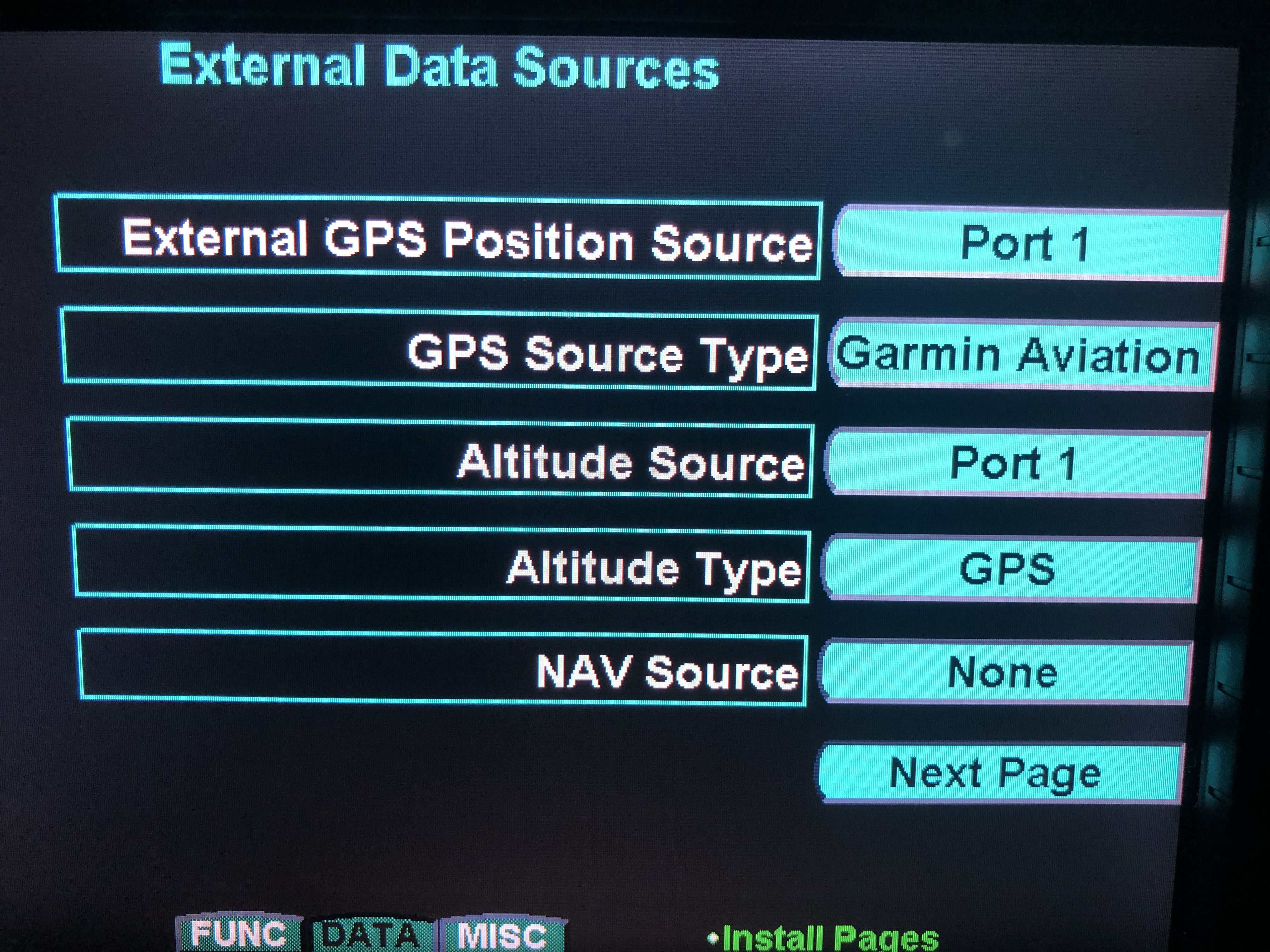
Do you have an install manual for the GMX? If so, go into config mode and check you gps data source. It should be AVIATION or MAPCOM, and confirmwhich port is connected to the source. Then check your 430 config pages and confirm it's outputting the proper format to the proper port. "Garmin Aviation" is best.
Both install manuals for the 430 and GMX are available on the web.
I misunderstood your original post. If your 430W has established and is showing your position, it should appear on the GmX. sounds like a config problem.
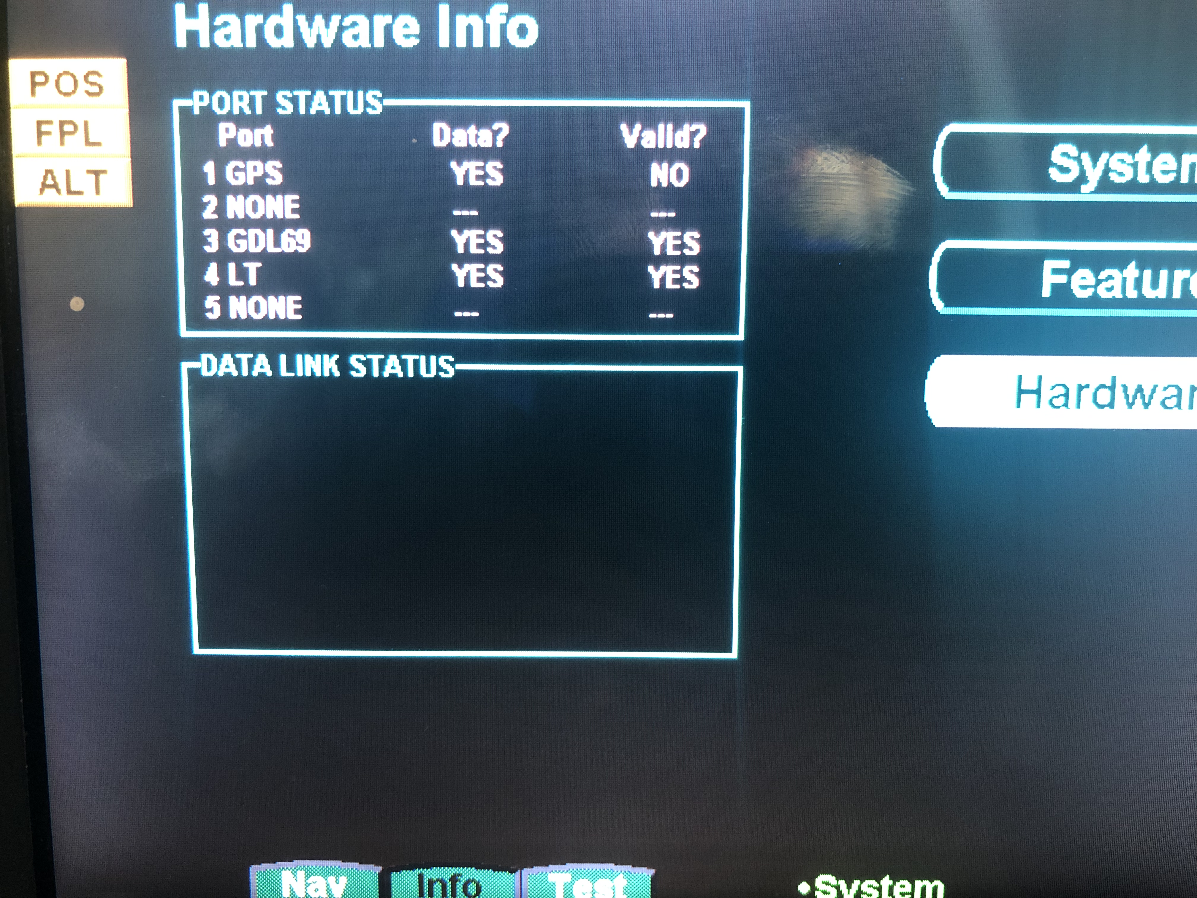
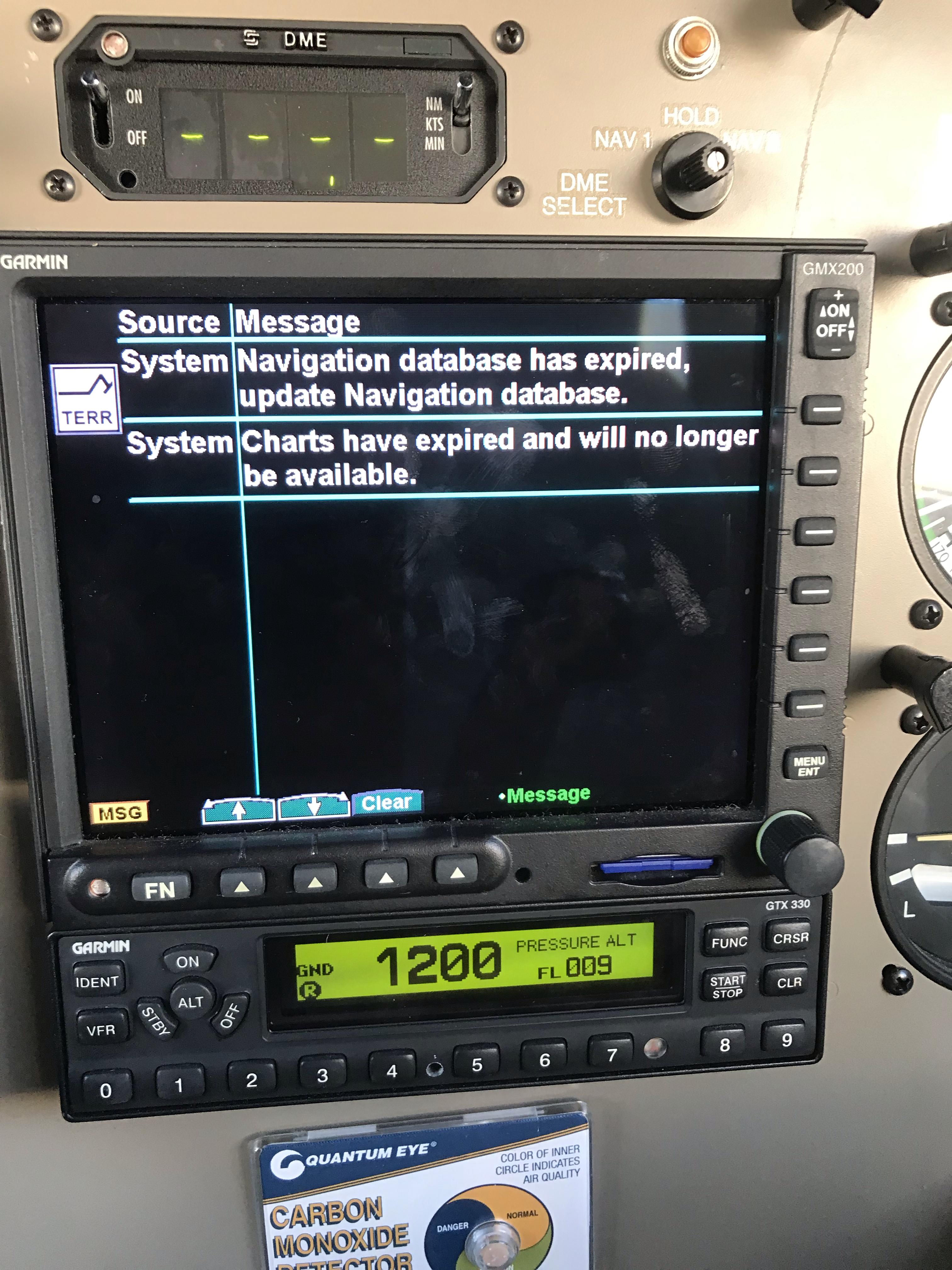
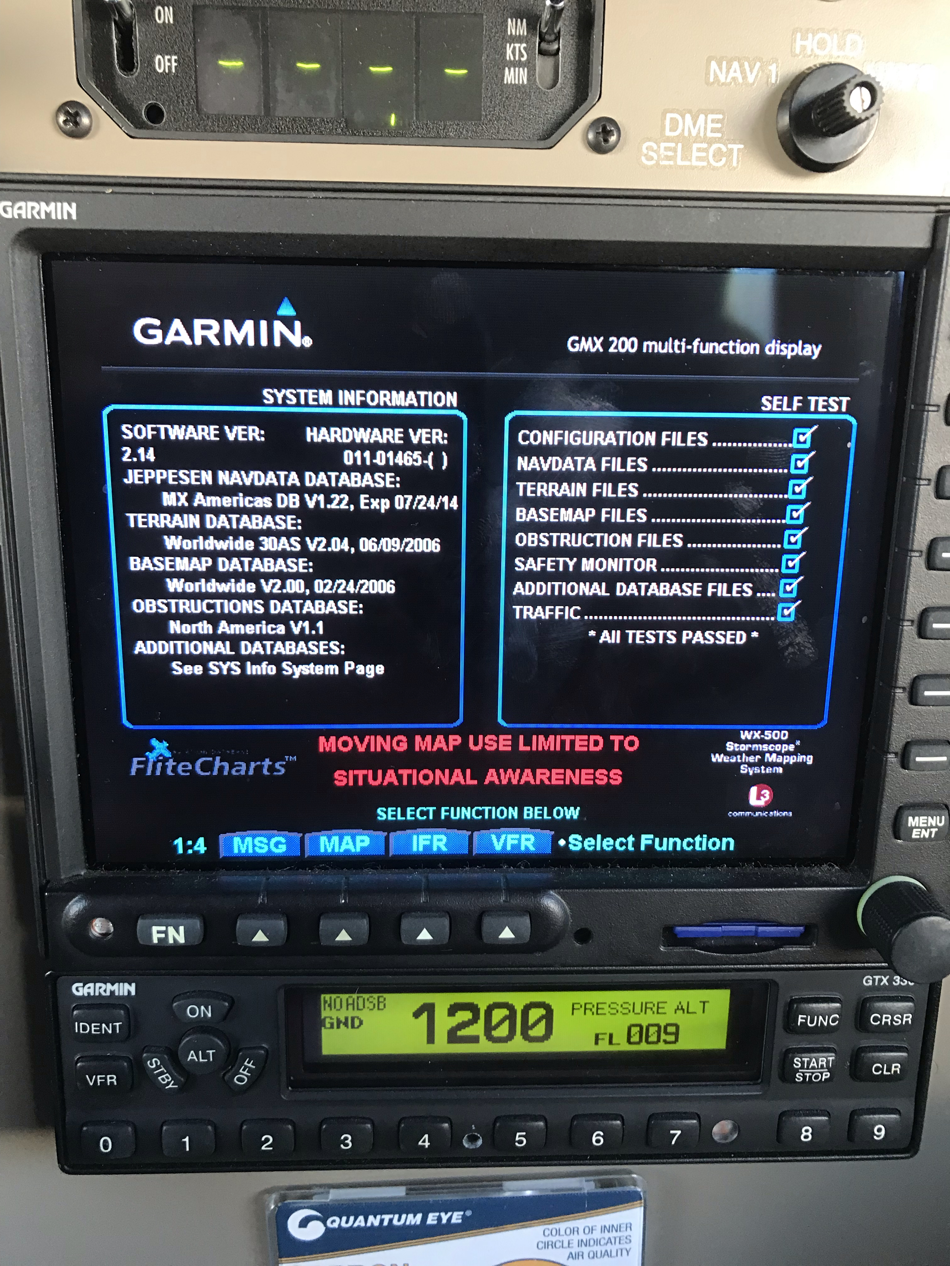
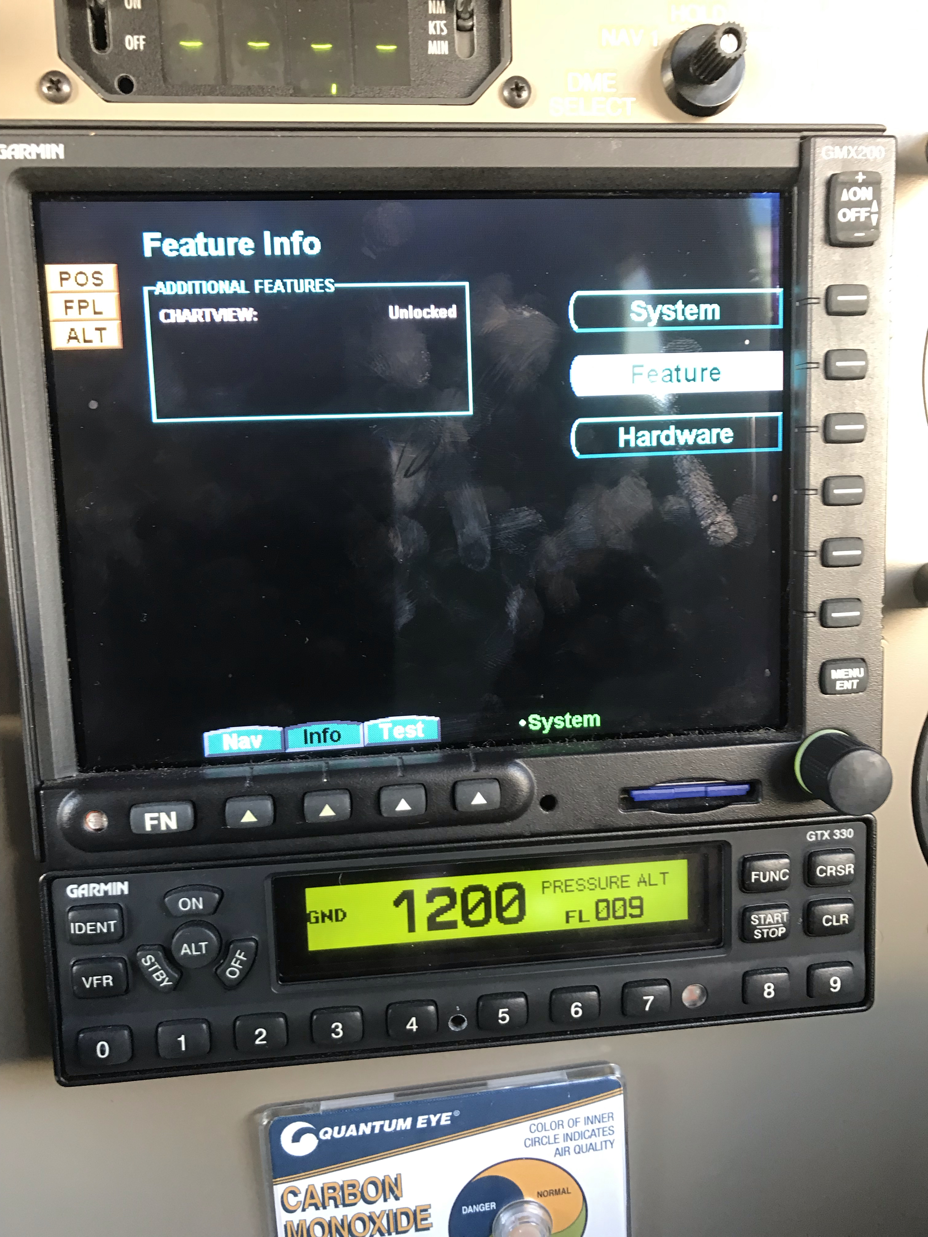
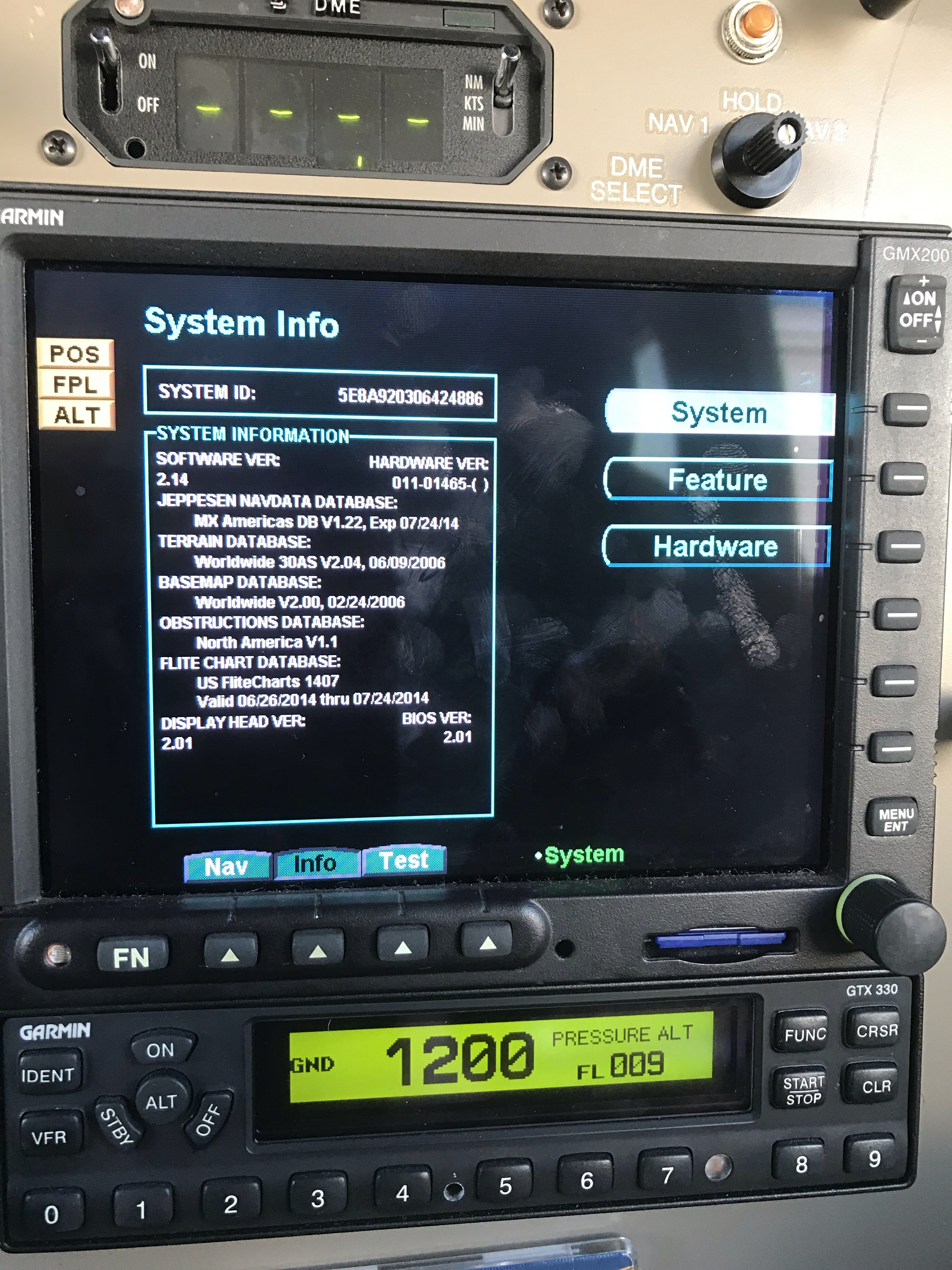
You have data, but it's invalid, so it's probably not set to the proper format for what your 430 is txing. Show us your GMX config external data page. It will show position source, GPS source type. Reference page 5-7 of the gmx install manual. What you're showing us here is not in the configuration menu, but the self-test. You need to get into the config menus. Instructions are on page 5-1 of the IM.
When I change it to MapMX on the 430W I get the ALT yellow flag
You get the alt yellow flag because the GMX is expecting GPS altitude and isn't getting seeing it in Map MX format. The photo shows your GMX is configured for Garmin Aviation data, which is good. Now you have to 1) get into your 430 config and see that it's txing RS232 aviation on port 1. Show us those pics too, if you can.
Reference page 5.6 in the 400 series IM.
If the 430 configs are correct, I got nuthin'. Maybe check wiring, slap an oscilloscope on the port 1 data lines and see if the square waves are clean, or hook a laptop serial port to the output and look at the data stream.