Zion Nat'l Park (Hurricane UT)

Pilawt

Final Approach
Joined
Sep 19, 2005
Messages
9,478
Location
Santa Rosita State Park, under the big 'W'
Display Name

Display name:
Pilawt
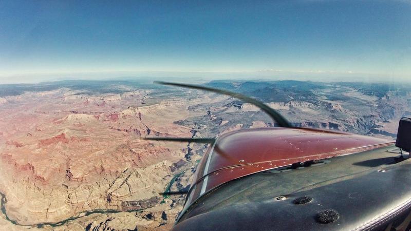
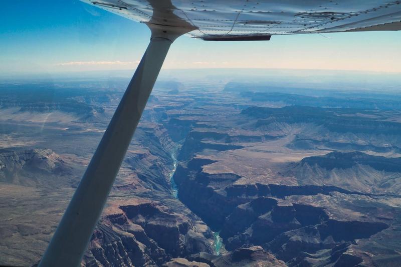
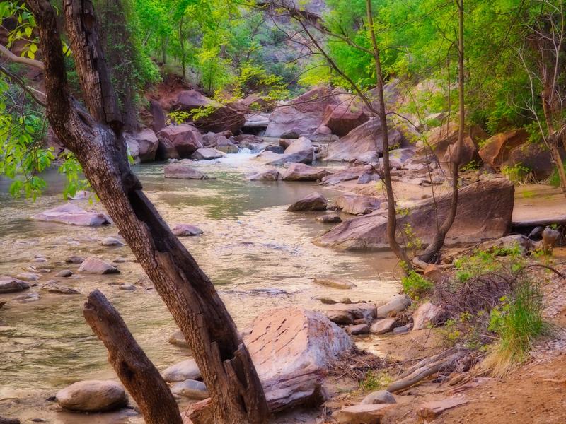
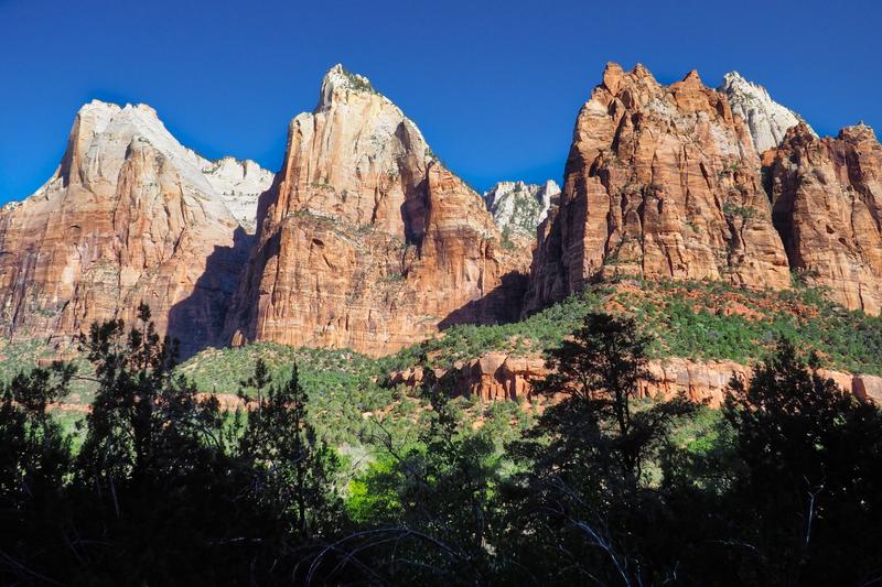
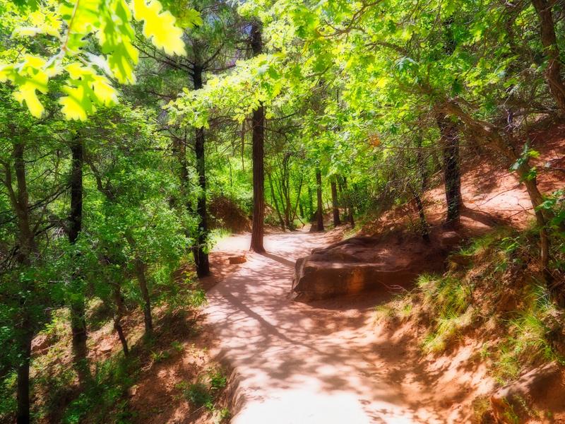
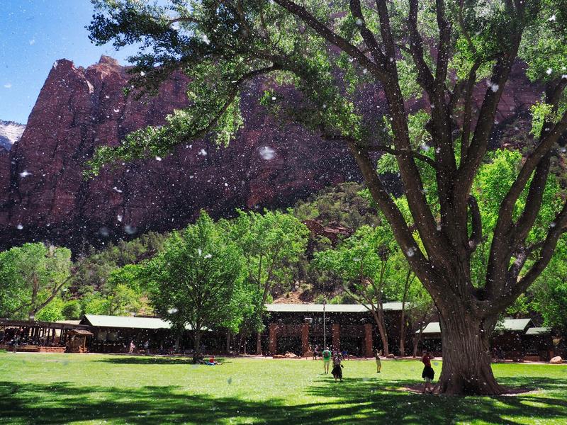
Once a year a rag-tag gaggle of pilots gets together for a couple of days of hiking and sightseeing in some backcountry and/or other scenic location. This year it was Zion National Park in southern Utah.

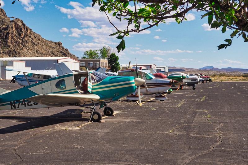
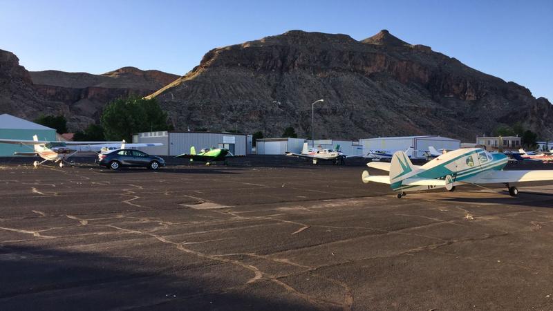
We gathered at Hurricane UT* (1L8), 25 miles from the Park entrance, for the closest available reasonably-priced lodging. The fleet this year was a Mooney M20E and a Bellanca Cruisair from southwest Washington, an RV-8 from northern California, and my 172 from Phoenix.

Good times.

[*pronounced "Herkin" by the locals :D ]


Awesome photos! We drove up there from Vegas a couple of years back and enjoyed every minute of it. Looks like a great trip!
 
WOW this is on my bucket list!!! Great photos!
 
Wow nice! Out of curiosity how often were you over nasty terrain? Did you stay over roads, etc in case of engine failure?
 
Gorgeous! Wife and I hiked Angel's Landing - thought it was steep, tough hike.
Then on the next day we hiked another trail and ended up looking waay down on Angel's Landing! Stunning hikes. One of them was known for a murder where a guy pushed his wife off into the abyss, and apparently the jury hiked up to see the scene.
 
Nice! Was the Narrows open?
 
how often were you over nasty terrain? Did you stay over roads, etc in case of engine failure?
It's really not as scary as it looks on the chart. The route was GYR - KARLO - 1Z1 - 1L8 (slight dogleg to the west to avoid the Flight Free Zone over the Grand Canyon). The worst terrain is over the Bradshaw Mountains southwest of Prescott; beyond that it mostly looked like this:

E2E1D806-0868-4AD2-BCBA-50241EC19682.png

Even in the remote areas near the Grand Canyon there are a lot of relatively level places and/or dirt roads that would accommodate at least a "good" landing (can walk away from), if not a "great" one (can use the airplane again). In the Canyon itself is 1Z1, the Grand Canyon Bar Ten Ranch airstrip.
 
Gorgeous! Wife and I hiked Angel's Landing - thought it was steep, tough hike.
Was the Narrows open?
The other three guys did the Narrows on Tuesday and Angels Landing on Wednesday. My knee was acting up so I stayed on the "easy" trails on the valley floor and concentrated on photography.
 
It's really not as scary as it looks on the chart. The route was GYR - KARLO - 1Z1 - 1L8 (slight dogleg to the west to avoid the Flight Free Zone over the Grand Canyon). The worst terrain is over the Bradshaw Mountains southwest of Prescott; beyond that it mostly looked like this:

View attachment 63176

Even in the remote areas near the Grand Canyon there are a lot of relatively level places and/or dirt roads that would accommodate at least a "good" landing (can walk away from), if not a "great" one (can use the airplane again). In the Canyon itself is 1Z1, the Grand Canyon Bar Ten Ranch airstrip.

Thanks for the feedback. Looks like you were cruising at 12,500?

That’s the only problem with my Cherokee 140...9-10,000 feet is about as high as it wants to go (I’ve been to 10,500 but it was painful getting there lol).

I need to make some trips up north, but I’ve always been a little gun shy with the performance of my plane.
 
Pretty smooth ride there? What time did you fly?
I took off from GYR 7:40 am Monday. It was smooth with little wind at 12,500', though I heard someone down low complaining about turbulence near PRC. Coming back Thursday I had to wait until 9 am Utah time to return the rental car, so I wasn't off until an hour later. I was flying down the west side of a high pressure area with a strong headwind, and at times I felt like a pair of sneakers in a spin dryer.

The Flightaware graphs show the difference ... the fluctuations in groundspeed reflect the up-and-down drafts.

Screen Shot 2018-05-19 at 1.20.43 PM.png

Screen Shot 2018-05-19 at 1.21.11 PM.png
 
Last edited:
I took off from GYR 7:40 am Monday. It was smooth with little wind at 12,500', though I heard someone down low complaining about turbulence near PRC. Coming back Thursday I had to wait until 9 am Utah time to return the rental car, so I wasn't off until an hour later. I was flying down the west side of a high pressure area with a strong headwind, and at times I felt like a pair of sneakers in a spin dryer.

The Flightaware graphs show the difference ... the fluctuations in groundspeed reflect the up-and-down drafts.

View attachment 63184

View attachment 63185

Glad you made it out alive
 
I was there April 1, did narrows, amazing place
 
Awesome photos! We drove up there from Vegas a couple of years back and enjoyed every minute of it. Looks like a great trip!

When the wife and I lived in Vegas, we drove up to Bryce Canyon and Escalante, driving through a portion of Zion on the way. Unfortunately, our plans to return to the area and spend more time in Zion never happened before we moved from Vegas.
 
Nice pics! Great time of year for that trip!
 
Back
Top